
IMAGES TAKEN NEAR TO
Mayfield Avenue, IMMINGHAM, DN40 3DF
Introduction
This page details the photographs taken nearby to Mayfield Avenue, DN40 3DF by members of the Geograph project.
The Geograph project started in 2005 with the aim of publishing, organising and preserving representative images for every square kilometre of Great Britain, Ireland and the Isle of Man.

There are currently over 7.5m images from over14,400 individuals and you can help contribute to the project by visiting https://www.geograph.org.uk
Image Map
Images are licensed for reuse under creativecommons.org/licenses/by-sa/2.0
Notes
- Clicking on the map will re-center to the selected point.
- The higher the marker number, the further away the image location is from the centre of the postcode.
Image Listing (33 Images Found)
Images are licensed for reuse under creativecommons.org/licenses/by-sa/2.0
Image
Details
Distance
1
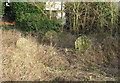
Overgrown Graves at the Old Baptist Chapel
For a picture of the Grade II listed Baptist Chapel, dating from 1792, see Image
Image: © David Wright
Taken: 2 Feb 2008
0.03 miles
2
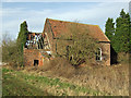
The Old Baptist Chapel
Photo shows the old Baptist chapel (listed grade II) on Baptist Chapel Lane. The building dates from 1792 - see English Heritage IoE http://www.imagesofengland.org.uk/details/default.aspx?id=165874 for further information.
Image: © David Wright
Taken: 2 Feb 2008
0.03 miles
3
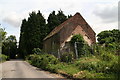
The old chapel in Baptist Chapel Lane, South Killingholme, 2016
Image: © Chris
Taken: 21 Jul 2016
0.03 miles
4
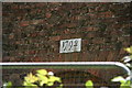
Datestone on chapel in Baptish Chapel Lane, South Killingholme
Image: © Chris
Taken: 21 Jul 2016
0.04 miles
5
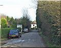
Baptist Chapel Lane
The Baptist Chapel Image is behind the hedge on the right of the picture.
Image: © David Wright
Taken: 2 Feb 2008
0.04 miles
7
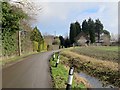
Baptist Chapel Lane, South Killingholme
At the southern edge of the village: the former chapel after which the lane is named is on the right - in a very neglected state, it does have what looked like a newly erected 'sold' sign on it, so it may be about to be rescued from complete dereliction.
Image: © Paul Harrop
Taken: 19 Feb 2017
0.06 miles
9
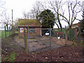
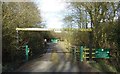
Anglian Water Pumping Station
The label on the gate states that this is the South Killingholme Baptist Chapel Lane TPS.
Image: © David Wright
Taken: 19 Jan 2008
0.08 miles
10
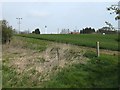
Field and Chimneys
The hill gives the illusion that chimneys grow out of the ground around these parts!!
Image: © John Beal
Taken: 22 Apr 2008
0.09 miles