1
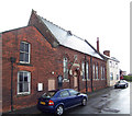
Former farm in Barnetby le Wold
Barnetby was a typical Wold's edge village until the coming of the Manchester, Sheffield and Lincolnshire Railway in 1848. The village developed a new centre close to the railway station characterised by brick terraces and a few villas. Recent decades have added commuter housing and the location close to a motorway junction gives easy access to Grimsby, Hull, Scunthorpe and beyond. But some traces of the old village still remain.
Image: © Jonathan Thacker
Taken: 6 Mar 2011
0.01 miles
2
Sing Fai, Barnetby-le-Wold
Sing Fai Chinese & Cantonese takeaway on Queens Road, Barnetby-le-Wold.
Image: © David Wright
Taken: 12 Jul 2006
0.03 miles
3
Cottage in Barnetby le Wold
Barnetby was a typical Wold's edge village until the coming of the Manchester, Sheffield and Lincolnshire Railway in 1848. The village developed a new centre close to the railway station characterised by brick terraces and a few villas. Recent decades have added commuter housing and the location close to a motorway junction gives easy access to Grimsby, Hull, Scunthorpe and beyond. But some traces of the old village still remain.
Image: © Jonathan Thacker
Taken: 6 Mar 2011
0.04 miles
4
Old Cottage in Barnetby le Wold
Barnetby was a typical Wold's edge village until the coming of the Manchester, Sheffield and Lincolnshire Railway in 1848. The village developed a new centre close to the railway station characterised by brick terraces and a few villas. Recent decades have added commuter housing and the location close to a motorway junction gives easy access to Grimsby, Hull, Scunthorpe and beyond. But some traces of the old village still remain.
Image: © Jonathan Thacker
Taken: 6 Mar 2011
0.04 miles
5
South Street, Barnetby le Wold
One of the older houses in the village
Image: © Paul Harrop
Taken: 13 Jan 2016
0.05 miles
6
Footpath, Barnetby le Wold
Image: © JThomas
Taken: 5 Aug 2011
0.06 miles
7
Queens Road, Barnetby le Wold
Image: © JThomas
Taken: 5 Aug 2011
0.06 miles
8
Footpath between streets at Barnetby le wold.
Interesting village with railway connections.
Image: © steven ruffles
Taken: 13 Jun 2020
0.07 miles
9
Sing Fai takeaway Barnetby
On Queens Road.
Image: © Steve Fareham
Taken: 20 Nov 2008
0.07 miles
10
Barnetby Methodist Church
Barnetby Methodist Church, West Street, Barnetby-le-Wold, North Lincolnshire.
Image: © David Wright
Taken: 1 Aug 2006
0.09 miles


