IMAGES TAKEN NEAR TO
Caistor Road, GRIMSBY, DN37 7JE
Introduction
This page details the photographs taken nearby to Caistor Road, DN37 7JE by members of the Geograph project.
The Geograph project started in 2005 with the aim of publishing, organising and preserving representative images for every square kilometre of Great Britain, Ireland and the Isle of Man.

There are currently over 7.5m images from over14,400 individuals and you can help contribute to the project by visiting https://www.geograph.org.uk
Image Map
Images are licensed for reuse under creativecommons.org/licenses/by-sa/2.0
Notes
- Clicking on the map will re-center to the selected point.
- The higher the marker number, the further away the image location is from the centre of the postcode.
Image Listing (14 Images Found)
Images are licensed for reuse under creativecommons.org/licenses/by-sa/2.0
Image
Details
Distance
2
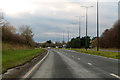
A46 near Laceby
A dual carriageway at this point.
Image: © J.Hannan-Briggs
Taken: 27 Nov 2015
0.09 miles
3

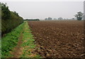
New Farm, Laceby
From the path that intersects the Wanderlust Way
Image: © Chris
Taken: 16 Aug 2014
0.12 miles
5
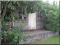
Well disguised nissen hut
Probably once used as a store but now almost invisible under its coat of vegetation.
Image: © Jonathan Thacker
Taken: 16 Aug 2012
0.13 miles
6
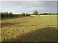
Field of peas near Laceby
These will be allowed to mature and dry rather than having been harvested green as garden peas.
Image: © Jonathan Thacker
Taken: 16 Aug 2012
0.16 miles
9
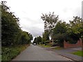
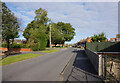
The Old Caistor road now a dead end at Laceby
Image: © Steve Fareham
Taken: 4 Sep 2015
0.18 miles