IMAGES TAKEN NEAR TO
Low Road, GRIMSBY, DN37 0SH
Introduction
This page details the photographs taken nearby to Low Road, DN37 0SH by members of the Geograph project.
The Geograph project started in 2005 with the aim of publishing, organising and preserving representative images for every square kilometre of Great Britain, Ireland and the Isle of Man.

There are currently over 7.5m images from over14,400 individuals and you can help contribute to the project by visiting https://www.geograph.org.uk
Image Map (Loading...)


Getting Data...Please wait
Leaflet Map data © OpenStreetMap
Images are licensed for reuse under creativecommons.org/licenses/by-sa/2.0
Notes
- Clicking on the map will re-center to the selected point.
- The higher the marker number, the further away the image location is from the centre of the postcode.
Image Listing (15 Images Found)
Images are licensed for reuse under creativecommons.org/licenses/by-sa/2.0
Image
Details
Distance
1
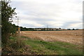
Hatcliffe towards Barnoldby le Beck: aerial 2023
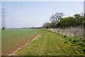
Two sides of a potential Medieval or Post Medieval enclosure were seen as earthworks. The possible enclosure is ditch-defined, centred at TA 2228 0133.
See: https://www.heritagegateway.org.uk/Gateway/Results_Single.aspx?uid=MNL2515&resourceID=1039
Image: © Simon Tomson
Taken: 19 Feb 2023
0.05 miles
2
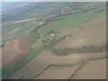
Hatcliffe Top to Ailsby and the Humber: aerial 2015
Waithe beck and the Wanderlust Way run through the valley on the left. Centre right is Barnoldby le Beck. The two single wind turbines are at Ailsby, just beyond Laceby.
Note the proliferation of windfarms on the north bank of the Humber.
Image: © Chris
Taken: 27 Dec 2015
0.06 miles
3
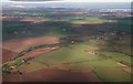
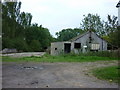
Road from Hatcliffe near the Old Farm
Taken from driveway of some derelict buildings. Cattle pens can be seen through the fence
Image: © John Firth
Taken: 7 Jun 2011
0.10 miles
4
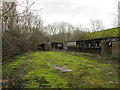
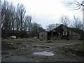
Derelict farm buildings near Old Farm
Image: © Jonathan Thacker
Taken: 22 Jan 2018
0.12 miles
8
Company, on the Wanderlust Way near Hatcliffe
A line of pylons marches alongside the path, or nearly.
Image: © Chris
Taken: 16 Aug 2014
0.13 miles
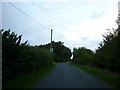
9
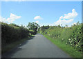
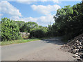
Road to Hatcliffe approaching The Old Farm
Image: © John Firth
Taken: 7 Jun 2011
0.14 miles