
IMAGES TAKEN NEAR TO
Cheapside, GRIMSBY, DN37 0HF
Introduction
This page details the photographs taken nearby to Cheapside, DN37 0HF by members of the Geograph project.
The Geograph project started in 2005 with the aim of publishing, organising and preserving representative images for every square kilometre of Great Britain, Ireland and the Isle of Man.

There are currently over 7.5m images from over14,400 individuals and you can help contribute to the project by visiting https://www.geograph.org.uk
Image Map
Images are licensed for reuse under creativecommons.org/licenses/by-sa/2.0
Notes
- Clicking on the map will re-center to the selected point.
- The higher the marker number, the further away the image location is from the centre of the postcode.
Image Listing (94 Images Found)
Images are licensed for reuse under creativecommons.org/licenses/by-sa/2.0
Image
Details
Distance
7
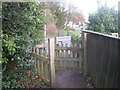
The end of the path
The path links Cheapside with Brigsley Road. Beyond the gate is a flight of steps which brings the path down to the level of Cheapside. For the other end of the path see Image
Image: © Jonathan Thacker
Taken: 10 Jan 2014
0.06 miles
8
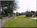
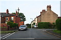
Cheapside, Waltham
Taken from the road junction with Barnoldby Road and High Street, this road heads east and in about 2 miles joins the A16 trunk road to the south of Holton-le-Clay. Wreaths laid adjacent to the war memorial can be seen.
Image: © John Beal
Taken: 2 Apr 2007
0.08 miles
10
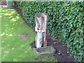
Forgotten village landmark in need of repair
Was repaired and used to irrigate garden in the 1970s water shortags.
Image: © G H Benfield
Taken: 28 Aug 2006
0.09 miles