
IMAGES TAKEN NEAR TO
Church Lane, GRIMSBY, DN37 0BQ
Introduction
This page details the photographs taken nearby to Church Lane, DN37 0BQ by members of the Geograph project.
The Geograph project started in 2005 with the aim of publishing, organising and preserving representative images for every square kilometre of Great Britain, Ireland and the Isle of Man.

There are currently over 7.5m images from over14,400 individuals and you can help contribute to the project by visiting https://www.geograph.org.uk
Image Map
Images are licensed for reuse under creativecommons.org/licenses/by-sa/2.0
Notes
- Clicking on the map will re-center to the selected point.
- The higher the marker number, the further away the image location is from the centre of the postcode.
Image Listing (21 Images Found)
Images are licensed for reuse under creativecommons.org/licenses/by-sa/2.0
Image
Details
Distance
1
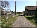
Derelict Farm
The track forms the bridleway, and passes through this derelict farm just on the outskirts of Bradley. OS maps indicate this may have been part of Bradley Manor.
Image: © John Beal
Taken: 5 Apr 2007
0.03 miles
2
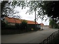
Manor House Farm Bradley another building site
The builders are advertising 12 individual homes
Image: © Martin Dawes
Taken: 29 Apr 2017
0.04 miles
3
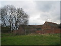
Derelict buildings, Bradley Manor
A large number of buildings formerly associated with Bradley Manor stand derelict. Given their close proximity to Grimsby it is surprising that some at least have not been converted to dwellings.
Image: © Jonathan Thacker
Taken: 21 Apr 2012
0.05 miles
4
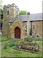
St George's Parish Church Bradley
Built of ironstone 13th Century with unbuttressed west tower. The cross in the churchyard has the full shaft and part of the crenellated top
Image: © Martin Dawes
Taken: 29 Apr 2017
0.05 miles
5
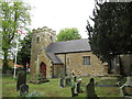
St George's Parish Church Bradley (2)
View across the churchyard, the church is now part of the West Grimsby Team Ministry. The church was built of ironstone in the 13th century, the cross in the churchyard has still got its full shaft and part of its crenellated top.
Image: © Martin Dawes
Taken: 29 Apr 2017
0.05 miles
7
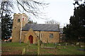
St.George's church, Bradley, Lincs.
Perilously close to Grimsby, Bradley retains its rustic charm and medieval church built of local ironstone. A tower which looks Norman but has 13th century bell openings and Decorated font with the inscription "Pater noster ave maria and criede leren ye chylde yt es nede" are the highlights.
Image: © Richard Croft
Taken: 24 Jan 2006
0.08 miles
8
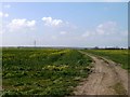
Bridlepath to the west
This bridlepath heads west out of Bradley, offering a choice of possible destinations via the many footpaths and bridleways in the area. Laceby is in the distance.
Image: © John Beal
Taken: 5 Apr 2007
0.08 miles
9
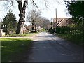
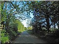
Bradley village
Very pleasant village within a few minutes of Grimsby's town centre. The quiet scene contrasts with the traffic on Bradley Road less than half a mile away.
Image: © John Beal
Taken: 5 Apr 2007
0.12 miles
10
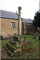
Ancient churchyard cross
A medieval (probably 15th century) cross in St.George's churchyard, Bradley.
Image: © Richard Croft
Taken: 24 Jan 2006
0.12 miles