IMAGES TAKEN NEAR TO
Humberston Road, GRIMSBY, DN36 5NR
Introduction
This page details the photographs taken nearby to Humberston Road, DN36 5NR by members of the Geograph project.
The Geograph project started in 2005 with the aim of publishing, organising and preserving representative images for every square kilometre of Great Britain, Ireland and the Isle of Man.

There are currently over 7.5m images from over14,400 individuals and you can help contribute to the project by visiting https://www.geograph.org.uk
Image Map
Images are licensed for reuse under creativecommons.org/licenses/by-sa/2.0
Notes
- Clicking on the map will re-center to the selected point.
- The higher the marker number, the further away the image location is from the centre of the postcode.
Image Listing (6 Images Found)
Images are licensed for reuse under creativecommons.org/licenses/by-sa/2.0
Image
Details
Distance
2
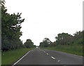
Long straight near Mink farm
Heading south. The cross roads at Tetney visible in distance
Image: © John Firth
Taken: 14 Jun 2012
0.09 miles
3
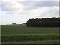
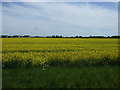
Farmland And Oil Tanks
The tanks are part of an oil terminal North-east of Tetney.
Image: © Roger Gilbertson
Taken: 4 Jan 2007
0.15 miles
4
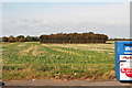
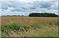
Tetney Beam Station woods
On the Tetney straight, in an area known as Bishopthorpe, is a modified brick building and makeshift industrial estate marking the site of the Marconi Beam station. This square wood (viewed from the Tetney recycling site at the crossroads) is the site of one of the masts.
The invention of the wireless beam system revolutionised overseas communication and made possible the use of telegraphic communication as an everyday necessity rather than a luxury.
Hence the Tetney Station has an important place in the history of international communication.
There were eight masts and various buildings. The three masts on the Grimsby side of the buildings carried the Australian aerials and were 275 feet tall.
The five masts on the Tetney side carried the Indian traffic and were 285 feet tall.
The masts were supported by stays which were anchored in concrete blocks 14 feet deep. The 3 square woods alongside the Tetney straight mark the sites of the masts - the concrete is still there, so the land cannot be worked. This is the southernmost wood. The middle wood is seen in Image
See: http://tetneybeamstation.blogspot.co.uk/
Image: © Chris
Taken: 12 Oct 2012
0.16 miles