IMAGES TAKEN NEAR TO
Holton Road, GRIMSBY, DN36 5LN
Introduction
This page details the photographs taken nearby to Holton Road, DN36 5LN by members of the Geograph project.
The Geograph project started in 2005 with the aim of publishing, organising and preserving representative images for every square kilometre of Great Britain, Ireland and the Isle of Man.

There are currently over 7.5m images from over14,400 individuals and you can help contribute to the project by visiting https://www.geograph.org.uk
Image Map (Loading...)


Getting Data...Please wait
Leaflet Map data © OpenStreetMap
Images are licensed for reuse under creativecommons.org/licenses/by-sa/2.0
Notes
- Clicking on the map will re-center to the selected point.
- The higher the marker number, the further away the image location is from the centre of the postcode.
Image Listing (13 Images Found)
Images are licensed for reuse under creativecommons.org/licenses/by-sa/2.0
Image
Details
Distance
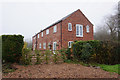
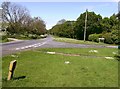
2
Tetney Hall Farm
Situated at North End, Tetney.
Image: © John Beal
Taken: 19 May 2007
0.06 miles
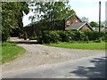
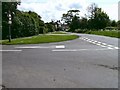
3
Arrival at Tetney
The entrance on the road from Holton-le-Clay passes through North End first before the main village is reached about half a mile away.
Image: © John Beal
Taken: 19 May 2007
0.08 miles
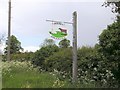
4
Tetney village sign, Best kept village 2012
Image: © Steve Fareham
Taken: 22 Jun 2013
0.11 miles
5
Inghams Road, Tetney
Leading off to the right and located at about the start of the main village with the main road leading out towards Holton-le-Clay.
Image: © John Beal
Taken: 19 May 2007
0.18 miles
6
Tetney village scene
As seen from Inghams Road.
Image: © John Beal
Taken: 19 May 2007
0.18 miles
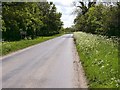
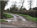
7
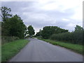
Holton Road
Heading north west towards Holton le Clay.
Image: © JThomas
Taken: 28 Aug 2015
0.22 miles
8
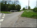
Ingham's Lane, Tetney
Looking northwards at the junction with the road to Holton-le-Clay.
Image: © John Beal
Taken: 19 May 2007
0.22 miles
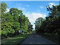
9
Distinctive farm sign
A place of only white horses and brown cows perhaps?
Image: © John Beal
Taken: 19 May 2007
0.22 miles
10
A Farm Track
A Public Footpath runs almost parallel to, and further than, the track towards New Waltham. The dead-end track itself appears not to be a Right of Way.
Image: © Roger Gilbertson
Taken: 4 Jan 2007
0.23 miles