IMAGES TAKEN NEAR TO
Paddock View, GRIMSBY, DN36 5JY
Introduction
This page details the photographs taken nearby to Paddock View, DN36 5JY by members of the Geograph project.
The Geograph project started in 2005 with the aim of publishing, organising and preserving representative images for every square kilometre of Great Britain, Ireland and the Isle of Man.

There are currently over 7.5m images from over14,400 individuals and you can help contribute to the project by visiting https://www.geograph.org.uk
Image Map (Loading...)


Getting Data...Please wait
Leaflet Map data © OpenStreetMap
Images are licensed for reuse under creativecommons.org/licenses/by-sa/2.0
Notes
- Clicking on the map will re-center to the selected point.
- The higher the marker number, the further away the image location is from the centre of the postcode.
Image Listing (15 Images Found)
Images are licensed for reuse under creativecommons.org/licenses/by-sa/2.0
Image
Details
Distance
10
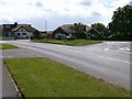
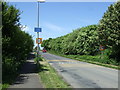
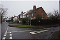
Road junction, Tetney
To the right Station Road, which used to lead to the railway station on the East Lincs line named "Holton-le-Clay and Tetney" before becoming just "Holton-le-Clay", heads west.
Image: © John Beal
Taken: 19 May 2007
0.16 miles