IMAGES TAKEN NEAR TO
Hurricane Close, GRIMSBY, DN36 5FN
Introduction
This page details the photographs taken nearby to Hurricane Close, DN36 5FN by members of the Geograph project.
The Geograph project started in 2005 with the aim of publishing, organising and preserving representative images for every square kilometre of Great Britain, Ireland and the Isle of Man.

There are currently over 7.5m images from over14,400 individuals and you can help contribute to the project by visiting https://www.geograph.org.uk
Image Map (Loading...)


Getting Data...Please wait
Leaflet Map data © OpenStreetMap
Images are licensed for reuse under creativecommons.org/licenses/by-sa/2.0
Notes
- Clicking on the map will re-center to the selected point.
- The higher the marker number, the further away the image location is from the centre of the postcode.
Image Listing (12 Images Found)
Images are licensed for reuse under creativecommons.org/licenses/by-sa/2.0
Image
Details
Distance
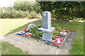
2
RAF Waltham memorials
The memorial consists of a number of elements with Station memorial, 100 squadron memorial and 2 information boards.
https://www.geograph.org.uk/photo/6260739
https://www.geograph.org.uk/photo/6260744
https://www.geograph.org.uk/photo/6260757
Image: © Adrian S Pye
Taken: 8 Sep 2019
0.11 miles
3
RAF Waltham memorial
"Do not attack the hornet's nest.
100 Squadron Royal Air Force Waltham, Grimsby
December 1942 - April 1945"
https://www.geograph.org.uk/photo/6260722
Image: © Adrian S Pye
Taken: 8 Sep 2019
0.11 miles
4
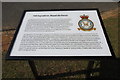
100 Squadron information board at RAF Waltham memorial site
https://www.geograph.org.uk/photo/6260722
Image: © Adrian S Pye
Taken: 8 Sep 2019
0.11 miles
5
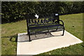
WW2 memorial seat
Can be seen featured in this image https://www.geograph.org.uk/photo/6260722
Image: © Adrian S Pye
Taken: 8 Sep 2019
0.12 miles
6
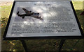
Information board, the Avro Lancaster at RAF Waltham memorial
https://www.geograph.org.uk/photo/6260722
Image: © Adrian S Pye
Taken: 8 Sep 2019
0.12 miles
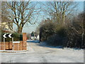
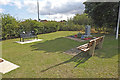
8
Street corner, Holton-le-Clay
A nice rural corner with a field crammed full of sheep.
Easy to get lost here so there's a map. Dog poo bin of course - every village needs one.
Image: © Chris
Taken: 16 Nov 2012
0.18 miles
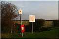
9
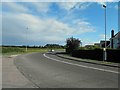
Going around the bend in Holton le Clay
Image: © Steve Fareham
Taken: 22 Jun 2013
0.18 miles
10
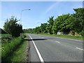
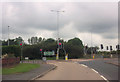
Louth Road (A16), heading north
Towards Grimsby.
Image: © JThomas
Taken: 25 May 2013
0.19 miles