IMAGES TAKEN NEAR TO
The Rowans, GRIMSBY, DN36 4BN
Introduction
This page details the photographs taken nearby to The Rowans, DN36 4BN by members of the Geograph project.
The Geograph project started in 2005 with the aim of publishing, organising and preserving representative images for every square kilometre of Great Britain, Ireland and the Isle of Man.

There are currently over 7.5m images from over14,400 individuals and you can help contribute to the project by visiting https://www.geograph.org.uk
Image Map
Images are licensed for reuse under creativecommons.org/licenses/by-sa/2.0
Notes
- Clicking on the map will re-center to the selected point.
- The higher the marker number, the further away the image location is from the centre of the postcode.
Image Listing (11 Images Found)
Images are licensed for reuse under creativecommons.org/licenses/by-sa/2.0
Image
Details
Distance
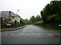
2
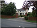
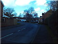
Canon Oakes Court, Humberston
A cul de sac off Humberston Avenue.
Image: © Richard Vince
Taken: 24 Feb 2024
0.18 miles
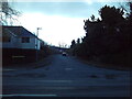
3
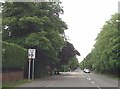
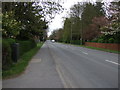
Humberston Avenue, Humberston
Looking towards the centre of the village from near its junction with Canon Oakes Court.
Image: © Richard Vince
Taken: 24 Feb 2024
0.20 miles
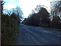
4
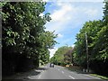
Humberstone Avenue approaching Grange Farm Lane
Lane off to left at roundabout
Image: © John Firth
Taken: 10 Jun 2013
0.20 miles
9
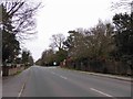
Grange Farm Lane, Humberston
Off Humberston Avenue, leading to a housing development just across the parish boundary into New Waltham.
Image: © Richard Vince
Taken: 24 Feb 2024
0.23 miles