IMAGES TAKEN NEAR TO
DN36 4AN
Introduction
This page details the photographs taken nearby to DN36 4AN by members of the Geograph project.
The Geograph project started in 2005 with the aim of publishing, organising and preserving representative images for every square kilometre of Great Britain, Ireland and the Isle of Man.

There are currently over 7.5m images from over14,400 individuals and you can help contribute to the project by visiting https://www.geograph.org.uk
Image Map (Loading...)


Getting Data...Please wait
Leaflet Map data © OpenStreetMap
Images are licensed for reuse under creativecommons.org/licenses/by-sa/2.0
Notes
- Clicking on the map will re-center to the selected point.
- The higher the marker number, the further away the image location is from the centre of the postcode.
Image Listing (5 Images Found)
Images are licensed for reuse under creativecommons.org/licenses/by-sa/2.0
Image
Details
Distance
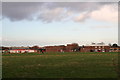

4
Humberstone Avenue
Entrance to Humberstone school on the right
Image: © John Firth
Taken: 11 Jul 2011
0.23 miles
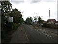
5
Humberston Avenue, Humberston (1)
Looking in the opposite direction from Image the junction with the A1031 road to Mablethorpe can be seen, and the young lady appears to be somewhat anxiously waiting for the next bus.
Image: © John Beal
Taken: 19 May 2007
0.25 miles