
IMAGES TAKEN NEAR TO
Lady Frances Crescent, CLEETHORPES, DN35 9JU
Introduction
This page details the photographs taken nearby to Lady Frances Crescent, DN35 9JU by members of the Geograph project.
The Geograph project started in 2005 with the aim of publishing, organising and preserving representative images for every square kilometre of Great Britain, Ireland and the Isle of Man.

There are currently over 7.5m images from over14,400 individuals and you can help contribute to the project by visiting https://www.geograph.org.uk
Image Map
Images are licensed for reuse under creativecommons.org/licenses/by-sa/2.0
Notes
- Clicking on the map will re-center to the selected point.
- The higher the marker number, the further away the image location is from the centre of the postcode.
Image Listing (13 Images Found)
Images are licensed for reuse under creativecommons.org/licenses/by-sa/2.0
Image
Details
Distance
2
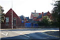
Please Sir, can we knock the school down?
You can, but you may not!
Though incredibly, the Council wanted to do just that, until it realised it could not afford to.
Outside is still the 'Matthew Humberstone School' sign, and a few cars in the carpark testify to an alternative use of part of the site.
See also Image
Image: © Chris
Taken: 12 Oct 2012
0.17 miles
3
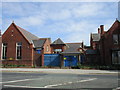
The former Matthew Humberstone School
Began life as Clee Grammar school. Now closed.
Image: © Jonathan Thacker
Taken: 27 May 2016
0.17 miles
4
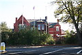
Please Sir, can we knock the school down?
You can, but you may not!
Though incredibly, the Council wanted to do just that, until it realised it could not afford to.
So now it has let the scrub grow in front of it to try to cover the shame of the grass growing in the gutters.
Leave it any longer, and there would be no photographs possible.
Image: © Chris
Taken: 12 Oct 2012
0.19 miles
6
Moat at Old Clee
Partly surrounds Old Clee Hall Farm.
Image: © Jonathan Thacker
Taken: 27 May 2016
0.22 miles
7

Clee Village
Not to be confused with Old Clee.
This was a settlement of wooden houses along a couple of private roads. The development was in similar in style to Humberstone Fitties (see TA3305).
Some of the old character and few of the old buildings (they may be replicas or modified) remain.
Image: © Chris
Taken: 26 Oct 2012
0.23 miles
9
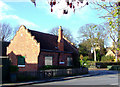
Old Clee, Grimsby
Old Clee Village Hall, Church Lane. (Grade II Listed) was built as a National School, c1870 for Alexander Grant - Thorold of Weelsby Old Hall in a style matching that of nearby Clee Hall Farmhouse. (qv)
http://www.flickr.com/photos/riffraff1/4101422232/
Image: © David Hebb
Taken: 27 Sep 2010
0.24 miles
10
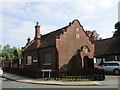
Former school, now Village Hall
Dates from 1870. Similar in style to a number of other buildings in the vicinity. Built by the Grant Thorold Estate. http://www.britishlistedbuildings.co.uk/en-478787-old-clee-village-hall-#.V0oNOkfkoeU
Image: © Jonathan Thacker
Taken: 27 May 2016
0.24 miles