
IMAGES TAKEN NEAR TO
Charles Street, CLEETHORPES, DN35 8QB
Introduction
This page details the photographs taken nearby to Charles Street, DN35 8QB by members of the Geograph project.
The Geograph project started in 2005 with the aim of publishing, organising and preserving representative images for every square kilometre of Great Britain, Ireland and the Isle of Man.

There are currently over 7.5m images from over14,400 individuals and you can help contribute to the project by visiting https://www.geograph.org.uk
Image Map
Images are licensed for reuse under creativecommons.org/licenses/by-sa/2.0
Notes
- Clicking on the map will re-center to the selected point.
- The higher the marker number, the further away the image location is from the centre of the postcode.
Image Listing (165 Images Found)
Images are licensed for reuse under creativecommons.org/licenses/by-sa/2.0
Image
Details
Distance
1
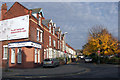
Oole Road, Cleethorpes
Photo taken looking across Cambridge Street at the junction with Yarra Road. I am told that Oole is one of the Thorpes of Clee. Before becoming a unified town, Cleethorpes was made up of three small villages, or "thorpes": Itterby, Oole and Thrunscoe, which were part of a wider parish called Clee.
Image: © David Wright
Taken: 15 Nov 2006
0.04 miles
2
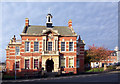
The Old Council House, Cambridge Street
Pevsner says "This is of 1904 by H.C.Scaping, brick with stone dressings, a small, crisply detailed Baroque facade with a lantern."
Image: © David Wright
Taken: 15 Nov 2006
0.05 miles
3
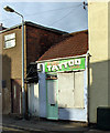
The Pro Tattoo Studio
The Pro Tattoo Studio on Sea View Street, Cleethorpes.
Image: © David Wright
Taken: 15 Nov 2006
0.05 miles
4
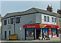
Today's Local Nisa Store
Shop on the corner of Cambridge Street and St. Peter's Avenue.
Image: © David Wright
Taken: 11 Jun 2007
0.06 miles
7
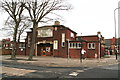
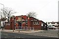
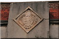
St.Peter's Church Hall
Image: © Chris
Taken: 7 Feb 2013
0.09 miles
8
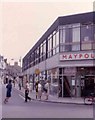
Street in Cleethorpes Lincs.
This photograph was taken when "Maypole" was still extant as a company
Image: © Jack Hill
Taken: 7 Aug 1968
0.09 miles
9
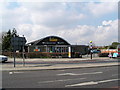
Cleethorpes Memorial Hall
The memorial hall, was built in 1960, to commemorate the lives of the people of Cleethorpes who died in the Second World War. The names of these people are listed on a Roll of Honour which flank the main entrance to the hall. There is a further plaque over the door and a plaque inside the vestibule commemorating the opening of the hall on 26th October, 1960, by the Lord Lieutenant of Lincolnshire, Earl of Ancaster.
Image: © John Readman
Taken: 16 Jun 2005
0.09 miles
10
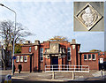
National School, Cambridge Street
The stone above the doorway (inset) dated 1856 came from a previous building.
Image: © David Wright
Taken: 15 Nov 2006
0.10 miles