IMAGES TAKEN NEAR TO
Cuttleby, CLEETHORPES, DN35 8LP

Introduction

This page details the photographs taken nearby to Cuttleby, DN35 8LP by members of the Geograph project.

The Geograph project started in 2005 with the aim of publishing, organising and preserving representative images for every square kilometre of Great Britain, Ireland and the Isle of Man.

There are currently over 7.5m images from over14,400 individuals and you can help contribute to the project by visiting https://www.geograph.org.uk

Image Map


Images are licensed for reuse under creativecommons.org/licenses/by-sa/2.0
Notes
  • Clicking on the map will re-center to the selected point.
  • The higher the marker number, the further away the image location is from the centre of the postcode.

Image Listing (395 Images Found)

Images are licensed for reuse under creativecommons.org/licenses/by-sa/2.0
  • ...
Image
Details
Distance
1
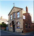
Old Cleethorpes Post Office
Former Cleethorpes Post Office on Yarra Road with a datestone of 1907
Image: © Richard Croft Taken: 3 Apr 2008
0.01 miles
2
WW1 air raid shelter
Believed to be the earliest civilian air raid shelter in Britain. Following a Zeppelin raid on 31st March 1916, enterprising resident Joseph Forrester of Yarra Road built this shelter behind his property. This grade II listed building https://historicengland.org.uk/listing/the-list/list-entry/1103483 has 0.5m thick walls and is now used as garage.
Image: © Richard Croft Taken: 3 Apr 2008
0.01 miles
3
Cuttleby: once a main thoroughfare
The white cottages date from the 1880's and are some of the oldest buildings in Cleethorpes. See Image There is conjecture as whether Cuttleby was one of the "Thorpes of Clee" (in the name "Cleethorpes", the other thorpes, or villages, being Oole, Thrunscoe and Itterby),but it has also been said that the alley got the name originally after a murder, a man was stabbed and it became known a "Cut Belly". See:http://www.rodcollins.com/wordpress/cleethorpes-history-a-look-into-the-past-of-cleethorpes).
Image: © Chris Taken: 7 Feb 2013
0.01 miles
4
Buildings on Albert Road
Cosgrove Street runs off to the left, with Mill Place behind and Cuttleby opposite. See: Image; Image and Image
Image: © Chris Taken: 7 Feb 2013
0.02 miles
5
Cuttleby and St.Peter's Children's Centre
This is the other end of the alley called Cuttleby (see: Image). The Children's Centre looks to have once been part of the adjacent St.Peter's "National School".
Image: © Chris Taken: 7 Feb 2013
0.02 miles
6
Cuttleby
The white cottages date from the 1880's and are some of the oldest buildings in Cleethorpes. See Image and Image There is conjecture as whether Cuttleby was one of the "Thorpes of Clee" (in the name "Cleethorpes", the other thorpes, or villages, being Oole, Thrunscoe and Itterby),but it has also been said that the alley got the name originally after a murder, a man was stabbed and it became known a "Cut Belly". See:http://www.rodcollins.com/wordpress/cleethorpes-history-a-look-into-the-past-of-cleethorpes). Also compare this photo with the earlier one in the above link.
Image: © Chris Taken: 7 Feb 2013
0.02 miles
7
The Old Post Office, Cleethorpes
This building, which bears the date 1907, is situated on the corner of Yarra Road and Oole Road. It is now the S & A Frames Art Centre.
Image: © David Wright Taken: 18 Nov 2006
0.02 miles
8
Terrace Shops on Alexandra Road.
This terrace of shops on Alexandra Road has retained the original cast-iron ornamentation. Photo taken from Yarra Road junction.
Image: © David Wright Taken: 18 Nov 2006
0.02 miles
9
Mill Place, opposite Cuttleby
House backs (including....) and pollarded trees where it seems a windmill once stood.
Image: © Chris Taken: 7 Feb 2013
0.02 miles
10
Yarra Road tenfoot
Opposite view of the tenfoot http://www.geograph.org.uk/photo/915439 behind Yarra Road
Image: © Richard Croft Taken: 3 Apr 2008
0.03 miles
  • ...