IMAGES TAKEN NEAR TO
Buck Beck Way, CLEETHORPES, DN35 0RJ
Introduction
This page details the photographs taken nearby to Buck Beck Way, DN35 0RJ by members of the Geograph project.
The Geograph project started in 2005 with the aim of publishing, organising and preserving representative images for every square kilometre of Great Britain, Ireland and the Isle of Man.

There are currently over 7.5m images from over14,400 individuals and you can help contribute to the project by visiting https://www.geograph.org.uk
Image Map
Images are licensed for reuse under creativecommons.org/licenses/by-sa/2.0
Notes
- Clicking on the map will re-center to the selected point.
- The higher the marker number, the further away the image location is from the centre of the postcode.
Image Listing (17 Images Found)
Images are licensed for reuse under creativecommons.org/licenses/by-sa/2.0
Image
Details
Distance
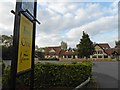
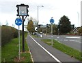
3
Belvoir Road
At Hollingsworth Close, Cleethorpes.
Image: © Roger Gilbertson
Taken: 4 Jan 2007
0.09 miles
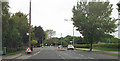
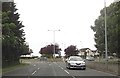
4
The Pear Tree Public House
On the Southern edge of Cleethorpes.
Image: © Roger Gilbertson
Taken: 4 Jan 2007
0.10 miles
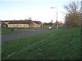
7
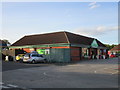
Part of Hewitt's Circus Retail Park
Image: © Jonathan Thacker
Taken: 9 Jun 2017
0.16 miles
9
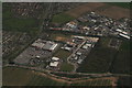
Retail Park and Industrial Estate by Hewitt's Circus, Cleethorpes: aerial 2016
Wilton Road Industrial Estate.
Peak's Covert right.
Image: © Chris
Taken: 19 Apr 2016
0.21 miles
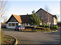
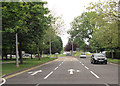
10
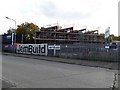
Not much happening today on this site, wonder why?
Image: © Steve Fareham
Taken: 12 Oct 2015
0.22 miles