IMAGES TAKEN NEAR TO
Eastfield Avenue, GRIMSBY, DN33 2PD
Introduction
This page details the photographs taken nearby to Eastfield Avenue, DN33 2PD by members of the Geograph project.
The Geograph project started in 2005 with the aim of publishing, organising and preserving representative images for every square kilometre of Great Britain, Ireland and the Isle of Man.

There are currently over 7.5m images from over14,400 individuals and you can help contribute to the project by visiting https://www.geograph.org.uk
Image Map (Loading...)


Getting Data...Please wait
Leaflet Map data © OpenStreetMap
Images are licensed for reuse under creativecommons.org/licenses/by-sa/2.0
Notes
- Clicking on the map will re-center to the selected point.
- The higher the marker number, the further away the image location is from the centre of the postcode.
Image Listing (10 Images Found)
Images are licensed for reuse under creativecommons.org/licenses/by-sa/2.0
Image
Details
Distance
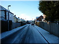
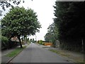
1
School's Out
The A16 as school ends for the day - and not a single cyclist is riding legally!
Image: © Roger Gilbertson
Taken: 4 Jan 2007
0.08 miles
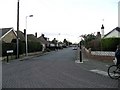
2
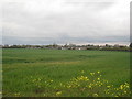
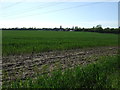
View towards Scartho
The southern end of the Grimsby built-up area.
Image: © Jonathan Thacker
Taken: 21 Apr 2012
0.10 miles
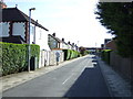
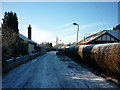
4
Croxby Avenue
In Scartho, a suburb of Grimsby.
Image: © Roger Gilbertson
Taken: 4 Jan 2007
0.11 miles
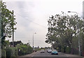
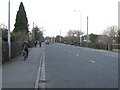
8
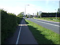
Cycle track beside Louth Road
Towards Grimsby.
Image: © JThomas
Taken: 25 May 2013
0.22 miles