
IMAGES TAKEN NEAR TO
Shetland Gardens, DONCASTER, DN2 6PR
Introduction
This page details the photographs taken nearby to Shetland Gardens, DN2 6PR by members of the Geograph project.
The Geograph project started in 2005 with the aim of publishing, organising and preserving representative images for every square kilometre of Great Britain, Ireland and the Isle of Man.

There are currently over 7.5m images from over14,400 individuals and you can help contribute to the project by visiting https://www.geograph.org.uk
Image Map
Images are licensed for reuse under creativecommons.org/licenses/by-sa/2.0
Notes
- Clicking on the map will re-center to the selected point.
- The higher the marker number, the further away the image location is from the centre of the postcode.
Image Listing (27 Images Found)
Images are licensed for reuse under creativecommons.org/licenses/by-sa/2.0
Image
Details
Distance
1
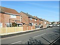
West side of Cornwall Road, Doncaster
Semi-detached houses built in the 1960s.
Image: © Christine Johnstone
Taken: 9 Apr 2022
0.08 miles
2
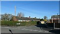
West side of Radnor Way, Doncaster
Five detached bungalows.
Image: © Christine Johnstone
Taken: 9 Apr 2022
0.10 miles
4
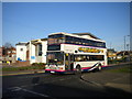
Bus on Sandringham Road, Intake
First South Yorkshire 34053, a Volvo Olympian/Northern Counties Palatine II, heads back to Doncaster town centre on route 65, having turned using the roundabout at the junction of Sandringham Road with Armthorpe Road. This bus was one of a batch built in 1996 for Centrewest for use on London route 607 (Uxbridge - Ealing - Shepherd's Bush); as this was a long, limited stop service, the buses were built with a single door and comfortable, generously pitched seats, all unusual features for London buses at the time.
I photographed this vehicle (when it was still numbered V53) at Uxbridge Station when it was new, and presumably travelled on it; it was something of a surprise to find a monster like this trundling up and down a short, lightly used route in Doncaster.
Image: © Richard Vince
Taken: 14 Jan 2012
0.14 miles
5
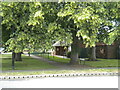
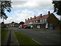
Marlow Close footpath, Intake
Linking Shaftesbury Avenue (foreground) with Marlow Road, and providing access to bungalows which are numbered as part of Marlow Close.
Image: © Richard Vince
Taken: 26 Jun 2021
0.14 miles
8
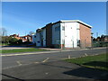
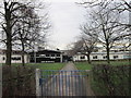
The Sandringham Centre, Doncaster
Home to the Sandringham Practice, a GPs and other specialists' practice with 21,000 patients.
Image: © Christine Johnstone
Taken: 9 Apr 2022
0.16 miles
10
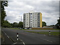
Block of flats off Shaftesbury Avenue, Intake
A fairly modestly dimensioned high rise block.
Image: © Richard Vince
Taken: 26 Jun 2021
0.17 miles