IMAGES TAKEN NEAR TO
Montrose Avenue, DONCASTER, DN2 6PN
Introduction
This page details the photographs taken nearby to Montrose Avenue, DN2 6PN by members of the Geograph project.
The Geograph project started in 2005 with the aim of publishing, organising and preserving representative images for every square kilometre of Great Britain, Ireland and the Isle of Man.

There are currently over 7.5m images from over14,400 individuals and you can help contribute to the project by visiting https://www.geograph.org.uk
Image Map (Loading...)


Getting Data...Please wait
Leaflet Map data © OpenStreetMap
Images are licensed for reuse under creativecommons.org/licenses/by-sa/2.0
Notes
- Clicking on the map will re-center to the selected point.
- The higher the marker number, the further away the image location is from the centre of the postcode.
Image Listing (19 Images Found)
Images are licensed for reuse under creativecommons.org/licenses/by-sa/2.0
Image
Details
Distance
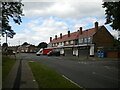
3
Houses on Kingston Road, Intake
A pair of prefabricated semi detached houses, neither of which has been fitted with concrete cladding (unlike the one visible on the extreme right).
Image: © Richard Vince
Taken: 26 Jun 2021
0.16 miles
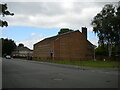
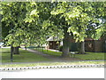
4

Copse off Northumberland Avenue, Intake
One of the green spaces that parallels Shaftesbury Avenue, the main distributor road through this part of Intake.
Image: © Richard Vince
Taken: 26 Jun 2021
0.17 miles
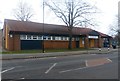
5
Harvest Fields Ministries, Evelyn Avenue, Intake
A very forbidding looking church whose architecture puts me in mind of a prison.
Image: © Richard Vince
Taken: 26 Jun 2021
0.17 miles
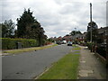
6
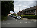
Grasmere Avenue, Intake
Off Northumberland Avenue.
Image: © Richard Vince
Taken: 26 Jun 2021
0.17 miles
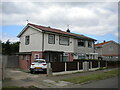
8
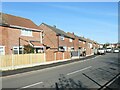
West side of Cornwall Road, Doncaster
Semi-detached houses built in the 1960s.
Image: © Christine Johnstone
Taken: 9 Apr 2022
0.18 miles
9
Marlow Close footpath, Intake
Linking Shaftesbury Avenue (foreground) with Marlow Road, and providing access to bungalows which are numbered as part of Marlow Close.
Image: © Richard Vince
Taken: 26 Jun 2021
0.18 miles
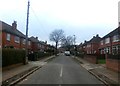
10
Northumberland Avenue, Intake
Seen from its junction with Grasmere Avenue.
Image: © Richard Vince
Taken: 26 Jun 2021
0.19 miles