IMAGES TAKEN NEAR TO
Lonsdale Avenue, DONCASTER, DN2 6HG
Introduction
This page details the photographs taken nearby to Lonsdale Avenue, DN2 6HG by members of the Geograph project.
The Geograph project started in 2005 with the aim of publishing, organising and preserving representative images for every square kilometre of Great Britain, Ireland and the Isle of Man.

There are currently over 7.5m images from over14,400 individuals and you can help contribute to the project by visiting https://www.geograph.org.uk
Image Map
Images are licensed for reuse under creativecommons.org/licenses/by-sa/2.0
Notes
- Clicking on the map will re-center to the selected point.
- The higher the marker number, the further away the image location is from the centre of the postcode.
Image Listing (10 Images Found)
Images are licensed for reuse under creativecommons.org/licenses/by-sa/2.0
Image
Details
Distance
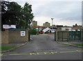
1
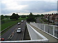
Leger Way
Appropriately named part of the A18 bordering Doncaster racecourse. Lancaster Avenue is the road by the housing estate on the right.
Image: © Oxana Maher
Taken: 29 May 2007
0.03 miles
2
Skateboard park by Doncaster Racecourse
Image: © Jonathan Thacker
Taken: 11 Jan 2014
0.05 miles
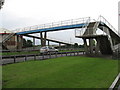
3
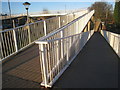
Footbridge zig-zag
Crosses the A18.
Image: © Jonathan Thacker
Taken: 11 Jan 2014
0.06 miles
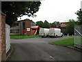
6
Plover Primary School
As it's half term, workmen are busy lopping trees while the kids are on holiday.
Image: © Oxana Maher
Taken: 29 May 2007
0.16 miles
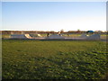
7
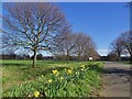
Daffodils on Sandall Beat Road
This tree-lined road runs parallel to the straight mile on Doncaster Reacecourse Image
Image: © Graham Hogg
Taken: 27 Mar 2023
0.17 miles
8
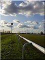
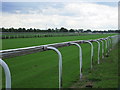
Straight mile.
Doncaster racecourse on a sunny day.
Image: © steven ruffles
Taken: 29 Jan 2010
0.18 miles
9
Doncaster racecourse
The long straight portion viewed from Sandall Beat Road
Image: © Oxana Maher
Taken: 29 May 2007
0.20 miles
10
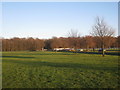
View towards Sandall Beat Wood
Sandall Beat Wood is an area of woodland planted by Doncaster Borough in the early nineteenth century as part of an attempt to replenish Britain's timber supply. It is now an area of pleasant woodland walks and recreational facilities.
The white fencing on the right is part of Doncaster Racecourse.
Image: © Jonathan Thacker
Taken: 11 Jan 2014
0.24 miles