
IMAGES TAKEN NEAR TO
Clay Lane West, DONCASTER, DN2 4QR
Introduction
This page details the photographs taken nearby to Clay Lane West, DN2 4QR by members of the Geograph project.
The Geograph project started in 2005 with the aim of publishing, organising and preserving representative images for every square kilometre of Great Britain, Ireland and the Isle of Man.

There are currently over 7.5m images from over14,400 individuals and you can help contribute to the project by visiting https://www.geograph.org.uk
Image Map
Images are licensed for reuse under creativecommons.org/licenses/by-sa/2.0
Notes
- Clicking on the map will re-center to the selected point.
- The higher the marker number, the further away the image location is from the centre of the postcode.
Image Listing (14 Images Found)
Images are licensed for reuse under creativecommons.org/licenses/by-sa/2.0
Image
Details
Distance
1
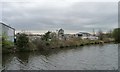
Keyline builders merchants, Little Lane
Seen from the barge Sobriety, heading from Goole to Sprotbrough.
Image: © Christine Johnstone
Taken: 4 Apr 2014
0.10 miles
2
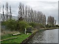
Line of poplars shielding a 'works', Long Sandall
On the east side of Clay Lane West. Seen from the barge Sobriety, heading from Goole to Sprotbrough.
Image: © Christine Johnstone
Taken: 4 Apr 2014
0.14 miles

4
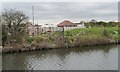
Boundary wall, Gypsy & Traveller site, Little Lane
Seen from the barge Sobriety, heading from Goole to Sprotbrough.
Image: © Christine Johnstone
Taken: 4 Apr 2014
0.16 miles
5
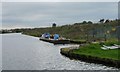
Moored workboat, west bank, Wheatley Cut, River Don
Seen from the barge Sobriety, heading from Goole to Sprotbrough.
Image: © Christine Johnstone
Taken: 4 Apr 2014
0.18 miles
7
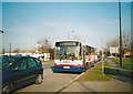
Bus on Barnby Dun Road, Wheatley Hills
First South Yorkshire 60572, a Volvo B10M/Alexander PS, stands in a queue of traffic blocking back from Clay Lane Roundabout while working route 84 to Doncaster town centre. This was Mainline's standard full size bus type for much of the 1990s: it eventually amassed 180 of the type, a significant proportion of the fleet.
Image: © Richard Vince
Taken: 16 Feb 2008
0.21 miles
8
Long Sandall lock
Set amongst industrial estates and rough ground.
Image: © steven ruffles
Taken: 14 Jan 2010
0.22 miles
9
Top gates opening, Long Sandall lock
Seen from the barge Sobriety, heading from Goole up to Sprotbrough.
Image: © Christine Johnstone
Taken: 4 Apr 2014
0.23 miles
10
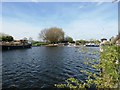
Don Navigation and Long Sandall Lock
Wheatley Cut of the Dun (Don) Navigation pictured from a slightly precarious position at the water's edge. The lock can be seen on the right where it forms an approximate benchmark for the Normal Tidal Limit (NTL).
Image: © Jonathan Clitheroe
Taken: 3 Apr 2017
0.23 miles