
IMAGES TAKEN NEAR TO
Norwich Road, DONCASTER, DN2 4QB
Introduction
This page details the photographs taken nearby to Norwich Road, DN2 4QB by members of the Geograph project.
The Geograph project started in 2005 with the aim of publishing, organising and preserving representative images for every square kilometre of Great Britain, Ireland and the Isle of Man.

There are currently over 7.5m images from over14,400 individuals and you can help contribute to the project by visiting https://www.geograph.org.uk
Image Map
Images are licensed for reuse under creativecommons.org/licenses/by-sa/2.0
Notes
- Clicking on the map will re-center to the selected point.
- The higher the marker number, the further away the image location is from the centre of the postcode.
Image Listing (11 Images Found)
Images are licensed for reuse under creativecommons.org/licenses/by-sa/2.0
Image
Details
Distance
1
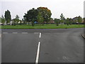
Estate Island
This island in the middle of Wheatley Park housing estate has six roads leading off it.
Image: © Michael Patterson
Taken: 16 Oct 2006
0.13 miles
3
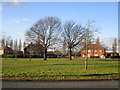
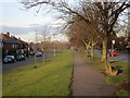
Another amenity area
But an amenity for whom? The planting of trees on this and other similar areas nearby makes them useless for children playing ball games and yet there doesn't seem to be much provision for children elsewhere. My visit coincided with half term and on a (relatively) warm, sunny day children were conspicuous by their absence.
Image: © Jonathan Thacker
Taken: 17 Feb 2015
0.18 miles

5
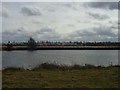
Looking across the canal to the shops at the Wheatley centre.
The buildings on the map have since been demolished.
Image: © steven ruffles
Taken: 15 Mar 2010
0.21 miles
8

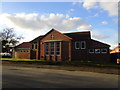
Traffic Lights onto Wheatley Hall Road
Image: © Steve Fareham
Taken: 21 Feb 2008
0.23 miles
9
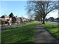
Thorne Road, Doncaster
On the right, the edge of Wheatley Hills, a 1920s and 1930s suburb. On the left, the edge of Wheatley Park, a 1950s suburb. The wide grassy area was created when Wheatley Park was built.
Image: © Christine Johnstone
Taken: 9 Apr 2022
0.23 miles
10
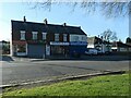
Four shops on Thorne Road, Doncaster
Built in the 1920s, when one of them was a Post Office. Now one sells security services, another DIY tools and the other two are takeaways.
Image: © Christine Johnstone
Taken: 9 Apr 2022
0.24 miles