IMAGES TAKEN NEAR TO
Avenue Road, DONCASTER, DN2 4AQ
Introduction
This page details the photographs taken nearby to Avenue Road, DN2 4AQ by members of the Geograph project.
The Geograph project started in 2005 with the aim of publishing, organising and preserving representative images for every square kilometre of Great Britain, Ireland and the Isle of Man.

There are currently over 7.5m images from over14,400 individuals and you can help contribute to the project by visiting https://www.geograph.org.uk
Image Map (Loading...)


Getting Data...Please wait
Leaflet Map data © OpenStreetMap
Images are licensed for reuse under creativecommons.org/licenses/by-sa/2.0
Notes
- Clicking on the map will re-center to the selected point.
- The higher the marker number, the further away the image location is from the centre of the postcode.
Image Listing (18 Images Found)
Images are licensed for reuse under creativecommons.org/licenses/by-sa/2.0
Image
Details
Distance
2
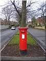
Avenue Road
A bright red post box at the Avenue Road/Thorne Road junction.
Image: © steven ruffles
Taken: 1 Jan 2010
0.14 miles
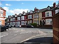
5
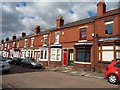
Houses, east side, Baxter Avenue, Doncaster
Unlike most of the nearby houses, these have no front gardens.
Image: © Christine Johnstone
Taken: 1 Sep 2014
0.17 miles
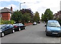
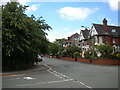
6
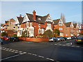
Doncaster - Victorian Crescent
Junction with Windsor Road
Image: © James Emmans
Taken: 14 Dec 2016
0.18 miles
7
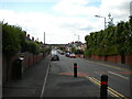
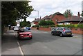
Norborough Road, Doncaster
Off Thorne Road.
Image: © Richard Vince
Taken: 26 Jun 2021
0.18 miles
8
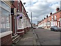
Baxter Avenue, Doncaster
Looking north-west.
Image: © Christine Johnstone
Taken: 1 Sep 2014
0.18 miles
9
Windsor Road, Doncaster
At its junction with Victorian Crescent.
Image: © Richard Vince
Taken: 26 Jun 2021
0.19 miles
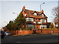
10
Houses, south-east side of Highfield Road, Doncaster
Seen from Baxter Avenue.
Image: © Christine Johnstone
Taken: 1 Sep 2014
0.19 miles