
IMAGES TAKEN NEAR TO
Barton Road, Caenby Corner Estate, GAINSBOROUGH, DN21 5TN
Introduction
This page details the photographs taken nearby to Barton Road, Caenby Corner Estate, DN21 5TN by members of the Geograph project.
The Geograph project started in 2005 with the aim of publishing, organising and preserving representative images for every square kilometre of Great Britain, Ireland and the Isle of Man.

There are currently over 7.5m images from over14,400 individuals and you can help contribute to the project by visiting https://www.geograph.org.uk
Image Map
Images are licensed for reuse under creativecommons.org/licenses/by-sa/2.0
Notes
- Clicking on the map will re-center to the selected point.
- The higher the marker number, the further away the image location is from the centre of the postcode.
Image Listing (41 Images Found)
Images are licensed for reuse under creativecommons.org/licenses/by-sa/2.0
Image
Details
Distance
1
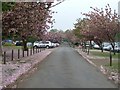
Cherry blossom avenue
The blossom is beginning to cover the ground as it finishes blooming.
Image: © Donnylad
Taken: 29 Apr 2006
0.05 miles
2
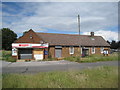
Abandoned shop, Hemswell Cliff
Hemswell Cliff is the name given to the former RAF Hemswell which is now in civilian use.
Image: © Jonathan Thacker
Taken: 7 Jul 2011
0.08 miles
3
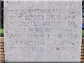
Memorial to former RAF Helmswell
Close up of detail
Image: © Tony Hibberd
Taken: 21 Jun 2013
0.08 miles
4
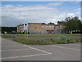
Hemswell Antiques
A former RAF accommodation block.
Image: © Jonathan Thacker
Taken: 7 Jul 2011
0.08 miles
5
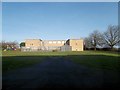
Building 2 from Building 1
Hemswell Antique Centre
Image: © John Firth
Taken: 24 Jan 2015
0.08 miles
6
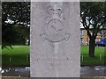
Memorial to former RAF Helmswell
Close up of detail
Image: © Tony Hibberd
Taken: 21 Jun 2013
0.08 miles
7
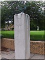
Memorial to former RAF Helmswell
Memorial adjacent to old parade square on this former WWII airfield
This is one of two memorials at this site
Image: © Tony Hibberd
Taken: 21 Jun 2013
0.08 miles
8
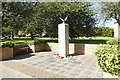
RAF Hemswell / Harpswell Memorial
The Royal Flying Corps opened this flying field as RFC Station Harpswell in 1916 and used as a night landing ground. Nos. 199 and 200 Training Squadrons were established at the airfield. Shortly after the end of WWI the site returned to farmland.
A new RAF Station, to be known as Hemswell, was built in the 1930s to a design for Bomber airfields and was one of a number of permanent bases being built to accommodate the then rapidly expanding Royal Air Force. Concrete runways weren't added until much later. Bomber Command was formed in 1936 and on 31st December 1936, Hemswell was opened as one of the first airfields within No.5 Group.
https://www.geograph.org.uk/article/Royal-Air-Force-Stations-in-Lincolnshire
Image: © Adrian S Pye
Taken: 17 Sep 2019
0.08 miles
9
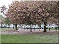
Cherry blossom time
The former aerodrome at Hemswell Cliff is now under multiple use. It hosts a large sunday market and is also home to a diverse range of business. There are some fine ornamental trees within its boundary, that have now reached maturity. These flowering Cherries, that form avenues either side of the old parade ground,have to be seen to be believed
Image: © Donnylad
Taken: 29 Apr 2006
0.09 miles
10
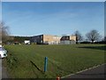
Hemswell Antique Centre building 2 from car park
Image: © John Firth
Taken: 24 Jan 2015
0.09 miles