IMAGES TAKEN NEAR TO
Trent Approach, GAINSBOROUGH, DN21 5FG

Introduction

This page details the photographs taken nearby to Trent Approach, DN21 5FG by members of the Geograph project.

The Geograph project started in 2005 with the aim of publishing, organising and preserving representative images for every square kilometre of Great Britain, Ireland and the Isle of Man.

There are currently over 7.5m images from over14,400 individuals and you can help contribute to the project by visiting https://www.geograph.org.uk

Image Map


Images are licensed for reuse under creativecommons.org/licenses/by-sa/2.0
Notes
  • Clicking on the map will re-center to the selected point.
  • The higher the marker number, the further away the image location is from the centre of the postcode.

Image Listing (49 Images Found)

Images are licensed for reuse under creativecommons.org/licenses/by-sa/2.0
  • ...
Image
Details
Distance
1
Trent Port Road, Marton
Heading west.
Image: © JThomas Taken: 29 Jun 2013
0.08 miles
2
Millennium Stone and Anchor
The anchor was dredged from the River Trent near to the Port of Marton and presented by Marton and Gate Burton Parish Council in 2003
Image: © Richard Croft Taken: 3 Feb 2016
0.10 miles
3
Early Norman Capital
Late 11th century capital in the chancel arch of St.Mary's church
Image: © Richard Croft Taken: 17 May 2008
0.10 miles
4
St.Margaret's nave
View west in St.Margaret's nave with a north arcade of c1175, early 13th century south arcade and early 12th century tower arch
Image: © Richard Croft Taken: 3 Feb 2016
0.11 miles
5
Ordnance Survey Cut Mark
This OS cut mark can be found on the north face of St Margaret's Church. It marks a point 8.439m above mean sea level.
Image: © Adrian Dust Taken: 26 May 2016
0.11 miles
6
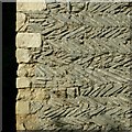
Church of St Margaret, Marton
Detail of herringbone masonry of the tower, with typical alternating long and short quoins.
Image: © Alan Murray-Rust Taken: 28 Sep 2017
0.11 miles
7
Church of St Margaret, Marton
The west wall of the south aisle incorporates decorative stonework of Saxon origin, variously described as parts of a cross shaft or jambs of an arch. Also visible to the left is the join of the original Saxon nave west wall, including herringbone masonry, with the later aisle.
Image: © Alan Murray-Rust Taken: 28 Sep 2017
0.11 miles
8
St Margaret of Antioch, Marton
Image: © Ian S Taken: 19 May 2018
0.11 miles
9
Church of St Margaret, Marton
View of the interior from the north side. 12th century Norman north arcade pillar with stiff leaf capital in the foreground, 13th century south arcade pillar beyond; 15th century windows in the south aisle. Victorian bench pews. At the left hand edge part of the late Saxon chancel arch is just visible. The church was not open at the time of my visit so I had to make do with views through the windows.
Image: © Alan Murray-Rust Taken: 28 Sep 2017
0.11 miles
10
St. Margaret's Church, Marton
Image: © JThomas Taken: 29 Jun 2013
0.11 miles
  • ...