
IMAGES TAKEN NEAR TO
Millstone Way, GAINSBOROUGH, DN21 4SQ
Introduction
This page details the photographs taken nearby to Millstone Way, DN21 4SQ by members of the Geograph project.
The Geograph project started in 2005 with the aim of publishing, organising and preserving representative images for every square kilometre of Great Britain, Ireland and the Isle of Man.

There are currently over 7.5m images from over14,400 individuals and you can help contribute to the project by visiting https://www.geograph.org.uk
Image Map
Images are licensed for reuse under creativecommons.org/licenses/by-sa/2.0
Notes
- Clicking on the map will re-center to the selected point.
- The higher the marker number, the further away the image location is from the centre of the postcode.
Image Listing (63 Images Found)
Images are licensed for reuse under creativecommons.org/licenses/by-sa/2.0
Image
Details
Distance
1
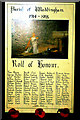
Parish of Waddingham 1914-1918 Roll of Honour
This Roll of Honour in the Church of St. Mary & St. Peter, Waddingham, Lincolnshire, records the names of 61 men who served in the Great War.
Image: © David Wright
Taken: 19 Feb 2006
0.06 miles
2
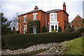
"The Villa", Church Road, Waddingham
This fine Victorian house stands next to the church.
Image: © David Wright
Taken: 19 Feb 2006
0.06 miles
3
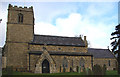
Waddingham Church
Church of St. Mary & St. Peter, Waddingham, Lincolnshire.
Image: © David Wright
Taken: 19 Feb 2006
0.06 miles
4

View across the Green to the Jubilee Hall
Waddingham is blessed with an unusually large (by Lincolnshire standards) village green.
Image: © Jonathan Thacker
Taken: 24 Mar 2012
0.06 miles
5
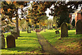
Church path
Churchyard path from St.Mary & St.Peter's church at Waddingham
Image: © Richard Croft
Taken: 20 Nov 2013
0.07 miles
6
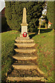
Waddingham War Memorial
War Memorial by the gates of St.Mary & St.Peter's church
Image: © Richard Croft
Taken: 20 Nov 2013
0.08 miles
7
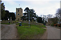
Church Road, Waddingham
The church of St. Mary & St. Peter is situated at the junction of Church Road and Church Lane. The war memorial can be seen to the left of the church tower.
Image: © David Wright
Taken: 19 Feb 2006
0.08 miles
9
"Glendale" - an Edwardian villa in Waddingham
Image: © Neil Theasby
Taken: 14 May 2020
0.08 miles
10

Ordnance Survey Cut Mark
This OS cut mark can be found on the south face of St Mary & St Peter's Church. It marks a point 17.234m above mean sea level.
Image: © Adrian Dust
Taken: 22 Jul 2017
0.08 miles