
IMAGES TAKEN NEAR TO
Grayingham, GAINSBOROUGH, DN21 4JD
Introduction
This page details the photographs taken nearby to DN21 4JD by members of the Geograph project.
The Geograph project started in 2005 with the aim of publishing, organising and preserving representative images for every square kilometre of Great Britain, Ireland and the Isle of Man.

There are currently over 7.5m images from over14,400 individuals and you can help contribute to the project by visiting https://www.geograph.org.uk
Image Map
Images are licensed for reuse under creativecommons.org/licenses/by-sa/2.0
Notes
- Clicking on the map will re-center to the selected point.
- The higher the marker number, the further away the image location is from the centre of the postcode.
Image Listing (6 Images Found)
Images are licensed for reuse under creativecommons.org/licenses/by-sa/2.0
Image
Details
Distance
1
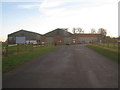
Grayingham Grange
Grayingham Grange is a working farm but some of the buildings have been given over to a farm shop and café under the name Uncle Henry's.
Image: © Jonathan Thacker
Taken: 17 Dec 2013
0.03 miles
2
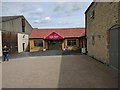
New entrance to Uncle Henry's
Uncle Henry's is the trading name for the farm shop at Grayingham Grange Farm. Originally housed in the stone built building to the right, this has been extended by adding the wooden building on a mock stone base.
For some reason they now enforce a one-way system, with entry here and exit at the other end of the building.
Image: © Bob Harvey
Taken: 21 Jul 2016
0.03 miles
3
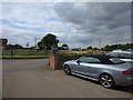
Playground at Uncle Henry's
Uncle Henry's is the trading name for the farm shop at Grayingham Grange Farm,
Grayingham
Image: © Bob Harvey
Taken: 21 Jul 2016
0.04 miles
4
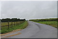
Road to Grayingham Grange
Facing back towards Ermine street.
Image: © J.Hannan-Briggs
Taken: 8 Jul 2012
0.08 miles
5
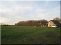
Farm cottage and woodland at Grayingham Grange
Image: © Jonathan Thacker
Taken: 17 Dec 2013
0.12 miles
