
IMAGES TAKEN NEAR TO
Southorpe Lane, GAINSBOROUGH, DN21 4AW
Introduction
This page details the photographs taken nearby to Southorpe Lane, DN21 4AW by members of the Geograph project.
The Geograph project started in 2005 with the aim of publishing, organising and preserving representative images for every square kilometre of Great Britain, Ireland and the Isle of Man.

There are currently over 7.5m images from over14,400 individuals and you can help contribute to the project by visiting https://www.geograph.org.uk
Image Map
Images are licensed for reuse under creativecommons.org/licenses/by-sa/2.0
Notes
- Clicking on the map will re-center to the selected point.
- The higher the marker number, the further away the image location is from the centre of the postcode.
Image Listing (12 Images Found)
Images are licensed for reuse under creativecommons.org/licenses/by-sa/2.0
Image
Details
Distance
1
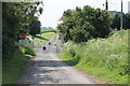
Swinesdyke Level Crossing
The road becomes a track after the gates. This is near Swinedyke Cottage.
Image: © J.Hannan-Briggs
Taken: 1 Jun 2014
0.01 miles
2
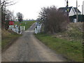
Swinesdyke level crossing, Southorpe Lane
Image: © Glyn Drury
Taken: 16 Mar 2010
0.02 miles
3
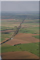
Swinedyke level crossing and Southorpe village
The railway runs north to Brigg.
The medieval village site is the grass field bottom right.
Image: © Chris
Taken: 5 May 2013
0.02 miles
4
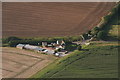
Swinedyke Level Crossing:aerial
This is an aerial shot of the crossing shown in Image, and Swinedyke Cottage, looking in almost the same direction.
Image: © Chris
Taken: 2 Sep 2012
0.02 miles
5
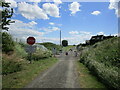
Swinedyke Crossing
A private crossing usually kept locked.
Image: © Jonathan Thacker
Taken: 1 Jul 2023
0.02 miles
6
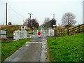
Swinedyke level crossing
Looking north to the metalled section of Southorpe Lane.
Image: © Jonathan Billinger
Taken: 31 Oct 2009
0.03 miles
7
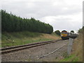
Train at Swinesdyke level crossing
66732 is hauling coal empties to Immingham.
Image: © Jonathan Thacker
Taken: 30 Aug 2010
0.04 miles
8
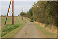
Southorpe lane
Dead end lane looking away from the railway line back towards Northorpe.
Image: © roger geach
Taken: 26 Sep 2011
0.08 miles
9
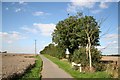
Southorpe Lane
Narrow, dead-end lane to the railway line, looking north.
Image: © Richard Croft
Taken: 8 Sep 2006
0.12 miles
10
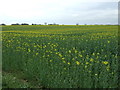
Oilseed rape crop, Cold Harbour Farm
Off Southorpe Lane.
Image: © JThomas
Taken: 5 Apr 2014
0.14 miles