IMAGES TAKEN NEAR TO
Gainsborough Road, GAINSBOROUGH, DN21 4AN
Introduction
This page details the photographs taken nearby to Gainsborough Road, DN21 4AN by members of the Geograph project.
The Geograph project started in 2005 with the aim of publishing, organising and preserving representative images for every square kilometre of Great Britain, Ireland and the Isle of Man.

There are currently over 7.5m images from over14,400 individuals and you can help contribute to the project by visiting https://www.geograph.org.uk
Image Map (Loading...)


Getting Data...Please wait
Leaflet Map data © OpenStreetMap
Images are licensed for reuse under creativecommons.org/licenses/by-sa/2.0
Notes
- Clicking on the map will re-center to the selected point.
- The higher the marker number, the further away the image location is from the centre of the postcode.
Image Listing (6 Images Found)
Images are licensed for reuse under creativecommons.org/licenses/by-sa/2.0
Image
Details
Distance
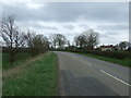
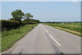
1
Grayingham Lodge Farm
By the B1205
Image: © Jonathan Billinger
Taken: 31 Jan 2007
0.09 miles
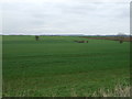
3
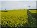
Oilseed rape and field boundary
Opposite Grayingham Lodge.
Image: © Jonathan Thacker
Taken: 15 May 2012
0.12 miles