
IMAGES TAKEN NEAR TO
Orchard Avenue, GAINSBOROUGH, DN21 3UA
Introduction
This page details the photographs taken nearby to Orchard Avenue, DN21 3UA by members of the Geograph project.
The Geograph project started in 2005 with the aim of publishing, organising and preserving representative images for every square kilometre of Great Britain, Ireland and the Isle of Man.

There are currently over 7.5m images from over14,400 individuals and you can help contribute to the project by visiting https://www.geograph.org.uk
Image Map
Images are licensed for reuse under creativecommons.org/licenses/by-sa/2.0
Notes
- Clicking on the map will re-center to the selected point.
- The higher the marker number, the further away the image location is from the centre of the postcode.
Image Listing (80 Images Found)
Images are licensed for reuse under creativecommons.org/licenses/by-sa/2.0
Image
Details
Distance
1
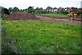
Green field site 2
The development of Astley Crescent is in its early stages in the spring of 2004. See 2008 shot for the completed development - Image
Image: © Jonathan Billinger
Taken: 12 May 2004
0.02 miles
2
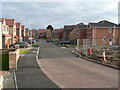
Astley Crescent - new extension, Scotter
These houses were built on a village infill site and finished just before the current credit crunch really began to bite.
Image: © Jonathan Billinger
Taken: 28 Dec 2008
0.04 miles
3
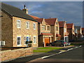
New housing in Scotter 2
These houses were built on a village infill site and finished just before the current credit crunch really began to bite.
Image: © Jonathan Billinger
Taken: 28 Dec 2008
0.05 miles
5
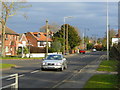
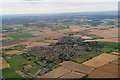
Gainsborough Road, A159, Scotter
Looking towards the village centre from the south.
Image: © Jonathan Billinger
Taken: 28 Dec 2008
0.06 miles
6
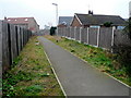
New footpath in Scotter
This links the new housing of Astley Crescent - Image - with the main road.
It covers the trench originally dug to put in services for the new houses.
Image: © Jonathan Billinger
Taken: 19 Mar 2009
0.06 miles
7
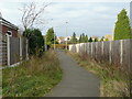
Link path in Scotter
This new right-of-way links new housing to the main road and the village centre.
Image: © Jonathan Billinger
Taken: 28 Dec 2008
0.06 miles
8

Green field site 1
Photo taken in spring 2004 as an access road has been put in to allow development of this field in Scotter. See Image for the same scene two years later.
Image: © Jonathan Billinger
Taken: 12 May 2004
0.06 miles
9
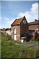
Soulby Farm Pigeoncote
Grade II listed, early 18th century pigeoncote at Soulby Farm, High Street, Scotter
The rest of Soulby Farm has been demolished and the site earmarked for development
Image: © Richard Croft
Taken: 11 Aug 2009
0.07 miles
10
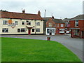
The Sun and Anchor, Scotter
The village local viewed from The Green.
Image: © Jonathan Billinger
Taken: 8 Sep 2009
0.07 miles