IMAGES TAKEN NEAR TO
Humber Bank West, BARROW-UPON-HUMBER, DN19 7RY
Introduction
This page details the photographs taken nearby to Humber Bank West, DN19 7RY by members of the Geograph project.
The Geograph project started in 2005 with the aim of publishing, organising and preserving representative images for every square kilometre of Great Britain, Ireland and the Isle of Man.

There are currently over 7.5m images from over14,400 individuals and you can help contribute to the project by visiting https://www.geograph.org.uk
Image Map
Images are licensed for reuse under creativecommons.org/licenses/by-sa/2.0
Notes
- Clicking on the map will re-center to the selected point.
- The higher the marker number, the further away the image location is from the centre of the postcode.
Image Listing (270 Images Found)
Images are licensed for reuse under creativecommons.org/licenses/by-sa/2.0
Image
Details
Distance
1

New Holland and New Holland Pier: aerial 2025 (2)
Before 1803 there wasn't even a New Holland, but just the creek somewhat opposite Hull on the south bank of the Humber. A small ferry service started from the creek in 1825, in fact a front for smuggling goods, especially gin, and it was Hollands gin that gave impetus to the naming of the place.
After the opening of the Humber Bridge in June 1981 the ferry was decommissioned. New Holland Pier was taken over by New Holland Bulk Services, who started a grain and animal food import and export in 1984.
See https://web.archive.org/web/20120422105623/http://www.pluralist.freeuk.com/newholl/history.html
Image: © Chris
Taken: 30 Dec 2025
0.02 miles
2
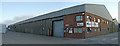
Storage Sheds at New Holland Dock
Photo taken from the public footpath.
Image: © David Wright
Taken: 17 Aug 2008
0.02 miles
3
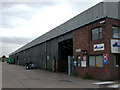
Timber Storage Shed at New Holland Dock
Photo taken from the public footpath.
Image: © David Wright
Taken: 24 Sep 2009
0.02 miles
4
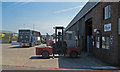
Cargo Handling Facilities at New Holland Dock
Image: © David Wright
Taken: 21 Jun 2010
0.02 miles
5

New Holland Docks and Industry: aerial 2025 (1)
Image: © Simon Tomson
Taken: 30 Dec 2025
0.03 miles
7
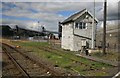
Barrow Road crossing signal box
This signal box dates from 1885 and controls the level crossing from where the picture has been taken . The Barton on Humber railway line is on the left , the rusty line on the right led onto the New Holland Pier which was a busy station until the Humber bridge opened. It then shut and is now used for industrial purposes as can be seen.No freight trains have used the link for some time.
Image: © roger geach
Taken: 12 Sep 2010
0.03 miles
8
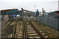
Railway lines to New Holland Pier
Prior to the withdrawal of the Humber ferry service in 1981 the pier was the northern end of the Great Grimsby and Sheffield Junction Railway and formed a connection with the ferry to Kingston upon Hull. The lines are still there but I don't know if they ever used to transport any of the bulk cargoes that the pier now services.
Image: © Graham Hogg
Taken: 16 Mar 2015
0.03 miles
9
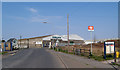
New Holland Level Crossing
Photo shows level crossing and signal box on left and entrance to station on right. In the background are the timber storage sheds of Messrs. Howarth.
Image: © David Wright
Taken: 31 Mar 2007
0.03 miles