
IMAGES TAKEN NEAR TO
Thorn Lane, BARROW-UPON-HUMBER, DN19 7LU
Introduction
This page details the photographs taken nearby to Thorn Lane, DN19 7LU by members of the Geograph project.
The Geograph project started in 2005 with the aim of publishing, organising and preserving representative images for every square kilometre of Great Britain, Ireland and the Isle of Man.

There are currently over 7.5m images from over14,400 individuals and you can help contribute to the project by visiting https://www.geograph.org.uk
Image Map
Images are licensed for reuse under creativecommons.org/licenses/by-sa/2.0
Notes
- Clicking on the map will re-center to the selected point.
- The higher the marker number, the further away the image location is from the centre of the postcode.
Image Listing (25 Images Found)
Images are licensed for reuse under creativecommons.org/licenses/by-sa/2.0
Image
Details
Distance
2
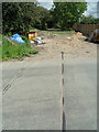
Old Rail Track - Thorn Lane, Goxhill
This is a remnant of the Barton and Immingham Light Railway (BILR) which was a single track line between Immingham West Junction and Goxhill. The passenger service opened in 1911 with some seven trains each way on weekdays and with an extra on Saturdays. There was no Sunday service. Up to closure in 1963 a fairly reasonable service of five round trips ran between Immingham Dock and New Holland Pier (ferry terminal for Hull), an extra trip was operated on Saturdays. Diesel railcars provided the services which were not heavily used and became a victim of rationalisation in June 1963 when the service was withdrawn.
Image: © David Wright
Taken: 15 Jul 2008
0.06 miles
3
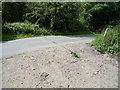
Railway Remnant - Thorn Lane, Goxhill
This is a remnant of the Barton and Immingham Light Railway (BILR) which was a single track line between Immingham West Junction and Goxhill. The passenger service opened in 1911 with some seven trains each way on weekdays and with an extra on Saturdays. There was no Sunday service. Up to closure in 1963 a fairly reasonable service of five round trips ran between Immingham Dock and New Holland Pier (ferry terminal for Hull), an extra trip was operated on Saturdays. Diesel railcars provided the services which were not heavily used and became a victim of rationalisation in June 1963 when the service was withdrawn.
Image: © David Wright
Taken: 15 Jul 2008
0.07 miles
4
Goxhill Church Side
Junction with Thorn Lane.
Image: © Chris
Taken: 10 Feb 2013
0.09 miles
5
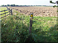
On the Public Footpath to Thorn Lane, Goxhill
The footpath route lies directly ahead across the ploughed field.
Image: © David Wright
Taken: 27 Sep 2008
0.10 miles
6
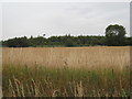
Looking north from Church Side to the old railway
The course of the former Goxill to Immingham railway track is marked by the line of bushes.
Image: © Jonathan Thacker
Taken: 9 Aug 2010
0.12 miles
7

The Public Footpath to Churchside, Goxhill
This public footpath runs from Thorn Lane to Churchside and appears to be little used.
Image: © David Wright
Taken: 27 Sep 2008
0.13 miles
9

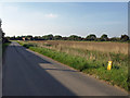
Track of the Barton to Immingham Railway
This was once part of the Barton & Immingham Light Railway which opened in 1911. The BILR linked Immingham with Hull via the Humber ferry at New Holland by joining with the Barton to Grimsby line near Goxhill. It closed in 1963 when the Humber bridge opened. The Immingham to Killingholme section is however still used for oil traffic Image
Image: © David Wright
Taken: 27 Sep 2008
0.15 miles
10

Tilled Field near Goxhill Hall
The hedgerow on the right marks the route of the dismantled railway.
Image: © David Wright
Taken: 27 Sep 2008
0.17 miles