1
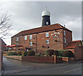
The Old Mill public house, Barton upon Humber
Image: © Ian S
Taken: 9 Feb 2011
0.02 miles
2
The Volunteer Arms
A roadside public house in Barton Upon Humber
Image: © Gail Franklin
Taken: 24 Feb 2011
0.02 miles
3
Castledyke South, Barton-upon-Humber, Lincolnshire
The Old Mill public house, Market Lane. Early 19th or late 18th century tower flour windmill without cap or sails, of 7 storeys in tarred brick. As seen from Castledyke South. Grade II Listed Building https://www.historicengland.org.uk/listing/the-list/list-entry/1346790
Image: © Bernard Sharp
Taken: 20 Apr 2017
0.02 miles
4
The Old Mill Public House
The Old Mill is situated on Market Place. For a picture of the inn sign see
Image
Image: © David Wright
Taken: 2 Dec 2007
0.02 miles
5
The Old Rate House - Whitecross Street
Image: © Betty Longbottom
Taken: 11 Sep 2009
0.03 miles
6
Whitecross Street, Barton-upon-Humber, Lincolnshire
The Old Rate House, No.17 Whitecross Street, dwelling, 18th century. So-named as it was once used as a collection point for the town's rates. Grade II Listed Building https://www.historicengland.org.uk/listing/the-list/list-entry/1083049
No.19 Whitecross Street, dwelling with gabled dormer, 18th century. Grade II Listed Building https://www.historicengland.org.uk/listing/the-list/list-entry/1045811
Image: © Bernard Sharp
Taken: 1 Jun 2017
0.03 miles
7
The Old Mill is now a pub
Image: © Chris Morgan
Taken: 16 Mar 2015
0.03 miles
8
Market Lane, Barton-upon-Humber, Lincolnshire
The Old Mill public house. Early 19th or late 18th century tower flour windmill without cap or sails, of 7 storeys in tarred brick. Grade II Listed Building https://www.historicengland.org.uk/listing/the-list/list-entry/1346790
Image: © Bernard Sharp
Taken: 5 Apr 2017
0.03 miles
9
Barton Upon Humber Tower Mill
For more information on this mill see http://microsites.lincolnshire.gov.uk/Windmills/section.asp?catId=3482
Image: © David Wright
Taken: 18 Jan 2008
0.03 miles
10
King's Garth Mill
Also known as The Old Mill as it now forms part of a public house called 'The Old Mill'. A seven-storey, former 6-sailed tower mill built in 1803, worked by wind until it lost a sail in 1868 and the remaining sails were removed for safety reasons. A gas engine powered the stones until c1950 and the mill became derelict thereafter until the summer of 1990 when the tower and associated buildings were converted into a pub & restaurant.
During development, an early Saxon burial ground was uncovered and 106 skeletons and associated burial goods were excavated, some of which can now be seen in Baysgarth Museum
Image: © Richard Croft
Taken: 7 Mar 2011
0.03 miles


