IMAGES TAKEN NEAR TO
Fleetgate, BARTON-UPON-HUMBER, DN18 5QE
Introduction
This page details the photographs taken nearby to Fleetgate, DN18 5QE by members of the Geograph project.
The Geograph project started in 2005 with the aim of publishing, organising and preserving representative images for every square kilometre of Great Britain, Ireland and the Isle of Man.

There are currently over 7.5m images from over14,400 individuals and you can help contribute to the project by visiting https://www.geograph.org.uk
Image Map
Images are licensed for reuse under creativecommons.org/licenses/by-sa/2.0
Notes
- Clicking on the map will re-center to the selected point.
- The higher the marker number, the further away the image location is from the centre of the postcode.
Image Listing (392 Images Found)
Images are licensed for reuse under creativecommons.org/licenses/by-sa/2.0
Image
Details
Distance
2
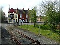
The end of the line at Barton-on-Humber station
Barton-on-Humber station was opened as part of a branch line from New Holland to Barton-on-Humber in 1849. Although it is a terminus, it was planned that the railway would extend westwards from Barton to Winterton and beyond, although this never happened.
This photograph is just beyond the buffers. A photograph looking in the other direction can be seen at www.geograph.org.uk/photo/7469164
Image: © Marathon
Taken: 22 Apr 2023
0.01 miles
3
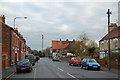
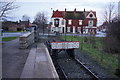
Dam Road, Barton Upon Humber
Photo taken looking towards Waterside Road. Dam Road was formerly known as Gas House Lane.
Image: © David Wright
Taken: 2 Jan 2009
0.01 miles
4
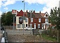
Barton on Humber station end of the line
The view from the station platform looking west . The station sign stands highlighting the station , without it one could easily miss the entrance.
Image: © roger geach
Taken: 12 Sep 2010
0.02 miles
6
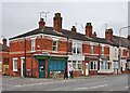
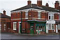
Waterside Road, Barton-upon-Humber, Lincolnshire
At the junction with Dam Road, Humber Terrace, Nos.1 to 8 Waterside Road, early 19th century. Shop and dwellings. Grade II Listed Building https://www.historicengland.org.uk/listing/the-list/list-entry/1083041
Image: © Bernard Sharp
Taken: 2 May 2017
0.02 miles
7
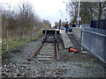
End of the line, Barton-upon-Humber Station
Image: © JThomas
Taken: 30 Mar 2013
0.02 miles
8
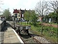
Barton-on-Humber station
Barton-on-Humber station was opened as part of a branch line from New Holland to Barton-on-Humber in 1849. Although it is a terminus, it was planned that the railway would extend westwards from Barton to Winterton and beyond, although this never happened.
Image: © Marathon
Taken: 22 Apr 2023
0.02 miles
9

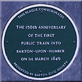
Plaque at Barton on Humber station
The plaque placed by the Barton Civic Society commemorates the coming of the railway to the town. Surprisingly, perhaps, the railway is still here 176 years later.
Image: © Stephen McKay
Taken: 17 Apr 2025
0.02 miles