
IMAGES TAKEN NEAR TO
Waterside Road, BARTON-UPON-HUMBER, DN18 5BH
Introduction
This page details the photographs taken nearby to Waterside Road, DN18 5BH by members of the Geograph project.
The Geograph project started in 2005 with the aim of publishing, organising and preserving representative images for every square kilometre of Great Britain, Ireland and the Isle of Man.

There are currently over 7.5m images from over14,400 individuals and you can help contribute to the project by visiting https://www.geograph.org.uk
Image Map
Images are licensed for reuse under creativecommons.org/licenses/by-sa/2.0
Notes
- Clicking on the map will re-center to the selected point.
- The higher the marker number, the further away the image location is from the centre of the postcode.
Image Listing (319 Images Found)
Images are licensed for reuse under creativecommons.org/licenses/by-sa/2.0
Image
Details
Distance
1

Waterside Road, Barton-upon-Humber, Lincolnshire
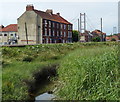
Nos.23 & 25 Waterside Road, early 19th century house, originally belonging to the windmill, Hewson's Lane. Now two houses. Grade II Listed Building https://www.historicengland.org.uk/listing/the-list/list-entry/1045883
Image: © Bernard Sharp
Taken: 13 Apr 2017
0.00 miles
2

Waterside Road, Barton-Upon-Humber
Looking north just beyond the railway station.
Image: © John Beal
Taken: 9 Oct 2008
0.03 miles
3
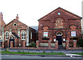
Old Chapel, Waterside Road
This old chapel on Waterside Road now houses a cycle shop.
Image: © David Wright
Taken: 27 Apr 2006
0.03 miles
4
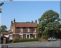
House on Waterside Road
Georgian house on Waterside Road near Maltkiln Road.
Image: © David Wright
Taken: 21 Sep 2006
0.03 miles
5
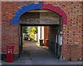
Clapson's Lane, Barton Upon Humber
Clapson's Lane is off Waterside Road and is home to the Barton ACF unit.
Image: © David Wright
Taken: 25 Sep 2007
0.03 miles
6
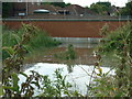
A walk to Winteringham #1
The start is from the main bus stop in Barton upon Humber. Bridge too low or water too high?
Image: © Ian S
Taken: 12 Aug 2010
0.03 miles
8
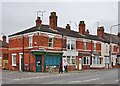
Waterside Road, Barton-upon-Humber, Lincolnshire
At the junction with Dam Road, Humber Terrace, Nos.1 to 8 Waterside Road, early 19th century. Shop and dwellings. Grade II Listed Building https://www.historicengland.org.uk/listing/the-list/list-entry/1083041
Image: © Bernard Sharp
Taken: 2 May 2017
0.04 miles
9
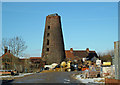
Hewson's Tower Mill, Barton Upon Humber
The redevelopment of this site has proceeded slowly since I visited a year ago Image - presumably due to the current unfavourable economic climate. For more information on this mill see http://microsites.lincolnshire.gov.uk/Windmills/section.asp?catId=3390
Image: © David Wright
Taken: 13 Feb 2009
0.04 miles
10
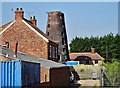
Hewson's Lane, Barton-upon-Humber, Lincolnshire
Eight-storey windmill built in 1813 for Cook & Sutton. The company went bankrupt in 1816 and, after a succession of owners, the mill remained in the Hewson family for over a century from the 1840s. The mill is linked to the two-storey house, right. Now derelict and for sale. Viewed from Waterside Road.
Grade II Listed Building https://www.historicengland.org.uk/listing/the-list/list-entry/1039878
Image: © Bernard Sharp
Taken: 10 May 2017
0.04 miles