IMAGES TAKEN NEAR TO
Chapel Lane, SCUNTHORPE, DN17 3AE
Introduction
This page details the photographs taken nearby to Chapel Lane, DN17 3AE by members of the Geograph project.
The Geograph project started in 2005 with the aim of publishing, organising and preserving representative images for every square kilometre of Great Britain, Ireland and the Isle of Man.

There are currently over 7.5m images from over14,400 individuals and you can help contribute to the project by visiting https://www.geograph.org.uk
Image Map (31 Images)


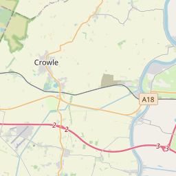
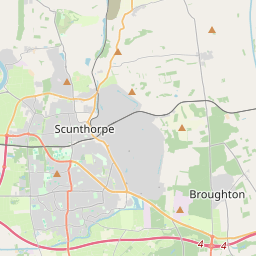
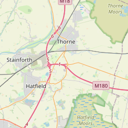
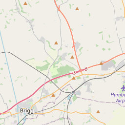

Leaflet Map data © OpenStreetMap
Images are licensed for reuse under creativecommons.org/licenses/by-sa/2.0
Notes
- Clicking on the map will re-center to the selected point.
- The higher the marker number, the further away the image location is from the centre of the postcode.
Image Listing (31 Images Found)
Images are licensed for reuse under creativecommons.org/licenses/by-sa/2.0
Image
Details
Distance
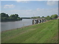
1

River Embankment in East Butterwick
On the left the flood embankments hide the River Trent.
Image: © DS Pugh
Taken: 7 May 2017
0.07 miles
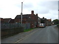
2
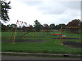
Children's playground, East Butterwick
Off Chapel Lane.
Image: © JThomas
Taken: 20 Sep 2014
0.07 miles
3
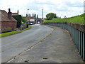
The High Street in East Butterwick
East Butterwick is a village in North Lincolnshire, on the east bank of the River Trent. On the right are the flood defences of the River Trent.
Image: © Mat Fascione
Taken: 21 May 2017
0.07 miles
5
High Street, East Butterwick
Looking south beside the River Trent.
Image: © JThomas
Taken: 20 Sep 2014
0.10 miles
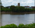
7
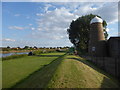
On the flood embankment at West Butterwick
The Shell Guide to Lincolnshire says of West Butterwick:- "A large Dutch-like village on the west bank of the Trent, looking across to East Butterwick village opposite." The former windmill adds to the Dutch feel and East Butterwick can be seen across the river in this photograph.
Most of the settlements on the west bank of the Trent have their counterparts on the east side, and numerous ferries plied between the two sides in former times. This is just now remembered in the various names involving 'ferry'.
Image: © Marathon
Taken: 8 Sep 2019
0.15 miles
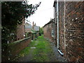
8
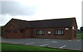
East Butterwick Village Hall
On Chapel Lane.
Image: © JThomas
Taken: 20 Sep 2014
0.15 miles
9
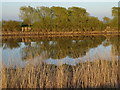
River Trent West Butterwick at low tide
View of River Trent at low tide
Image: © Bob Pearce
Taken: 23 Apr 2015
0.15 miles
10
Converted windmill at West Butterwick
Viewed from the opposite bank of the River Trent at East Butterwick.
Image: © Mat Fascione
Taken: 21 May 2017
0.15 miles