
IMAGES TAKEN NEAR TO
Bedford Way, SCUNTHORPE, DN15 8GF
Introduction
This page details the photographs taken nearby to Bedford Way, DN15 8GF by members of the Geograph project.
The Geograph project started in 2005 with the aim of publishing, organising and preserving representative images for every square kilometre of Great Britain, Ireland and the Isle of Man.

There are currently over 7.5m images from over14,400 individuals and you can help contribute to the project by visiting https://www.geograph.org.uk
Image Map
Images are licensed for reuse under creativecommons.org/licenses/by-sa/2.0
Notes
- Clicking on the map will re-center to the selected point.
- The higher the marker number, the further away the image location is from the centre of the postcode.
Image Listing (49 Images Found)
Images are licensed for reuse under creativecommons.org/licenses/by-sa/2.0
Image
Details
Distance
1

Normanby Grange, Scunthorpe
New housing development on the west side of Normanby Road
Image: © Paul Harrop
Taken: 17 Mar 2009
0.08 miles
2
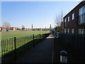
Pedestrian entrance to Crosby School
Runs alongside the school field. The school can be seen in the distance.
Image: © Jonathan Thacker
Taken: 26 Mar 2020
0.09 miles
3
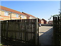
Pedestrian entrance to Normanby Grange Estate
The only one on the footpath that runs from Ferry Road to Phoenix Parkway.
Image: © Jonathan Thacker
Taken: 26 Mar 2020
0.09 miles
4
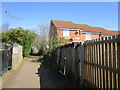
Footpath to Phoenix Parkway
The Normanby Grange Estate which lies to the east of this path has only one entrance to it (at the extreme south end of the estate) which as the path leads to both the Buckingham Avenue allotments and more importantly to the industrial area north of Phoenix Parkway. This seems rather shortsighted though I guess security is the excuse used. The locked double gates on the right of this picture could easily be replaced by a pedestrian entrance.
Image: © Jonathan Thacker
Taken: 26 Mar 2020
0.10 miles
5
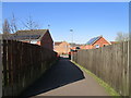
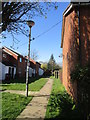
Path linking Normanby Road with Bedford Way
Image: © Jonathan Thacker
Taken: 26 Mar 2020
0.12 miles
7
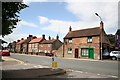
Old Crosby
19th century cottages in Old Crosby
Image: © Richard Croft
Taken: 21 Jun 2006
0.15 miles
8
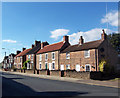
Old Crosby
A Scunthorpe Corporation Red Plaque on the central house (45-47 Old Crosby) dates it to the late 18th or early 19th century.
Image: © David Wright
Taken: 4 Oct 2007
0.16 miles
9
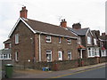
Ironstone cottage, Old Crosby
Little remains of the village of Crosby which existed before the expansion of Scunthorpe in the late nineteenth century. This cottage just predates that expansion.
Image: © Jonathan Thacker
Taken: 3 Nov 2011
0.16 miles
10
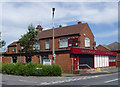
Ferry Road Club, Scunthorpe
On Ferry Road, near its junction with Frodingham Road
Image: © Paul Harrop
Taken: 1 Jul 2008
0.17 miles