1
Catholic Church of the Sacred Heart
On the corner of Treeton Road and Buttfield Road.
Image: © Chris
Taken: 22 Sep 2013
0.02 miles
2
Sacred Heart Church, Howden
Inside Sacred Heart Church, Howden
Image: © Ashley Lightfoot
Taken: 26 Aug 2007
0.03 miles
3
Sacred Heart Church
Looking along Buttfield Road from the junction with Treeton Road.
Image: © DS Pugh
Taken: 21 Jul 2013
0.03 miles
4
The Old Police Station, Howden
At the junction of Pinfold Street and Treeton Road, it was built in 1843 as a superintendent’s house with cells. It was designed by Henry Lockwood, who
erected similar buildings in Driffield and Market Weighton. He was also the architect of Trinity House in Hull and, with his partner William Mawson, designed the model industrial town at Saltaire in West Yorkshire.
Image: © Paul Harrop
Taken: 19 Apr 2009
0.06 miles
5
The Old Police Station in Howden
Former Superintendent's house located on the corner of Pinfold Street and Treeton Road. Howden Civic Society have erected an impressive array of plaques in the town highlighting places and buildings of note and one can be seen attached to this fine building.
Image: © Jonathan Clitheroe
Taken: 2 Apr 2016
0.06 miles
6
The Old Police Station
A blue plaque erected by Howden Civic Society reads "Built in 1843 as a Superintendent's house with cells, this fine building was designed by Henry Lockwood, who erected similar buildings in Driffield and Market Weighton. He was also the architect of Trinity House in Hull and, with his partner William Mawson, designed the mills at Saltaire"
Image: © Graham Hogg
Taken: 28 May 2015
0.09 miles
7
Blue Cedar Gardens
Off Knedlington Road in Howden.
Image: © DS Pugh
Taken: 21 Jul 2013
0.13 miles
8
The Ashes Playing Fields, Howden
The Ashes playing fields comprise 17 acres of land immediately south of Howden Minster donated to the trustees of the Ashes Playing Field Trust by Charles Briggs in 1927. This is the view from the car park on Treeton Road.
Image: © Stephen McKay
Taken: 23 Sep 2019
0.17 miles
9
Chestnuts, No.16, Pinfold St
A grade II listed house of two storeys, dated c1800, with alterations in the 1930's. Constructed in handmade brick, with front facade of machine made red brick, stone dressings and Westmorland slate roof. Central-hallway entry with a Tuscan porch. See
Image
LBS No:- 165359
Image: © Mike Kirby
Taken: 22 Oct 2014
0.18 miles
10
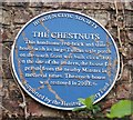
Chestnuts, blue plaque
Image: © Mike Kirby
Taken: 22 Oct 2014
0.18 miles


