IMAGES TAKEN NEAR TO
Spaldington Road, GOOLE, DN14 7NF
Introduction
This page details the photographs taken nearby to Spaldington Road, DN14 7NF by members of the Geograph project.
The Geograph project started in 2005 with the aim of publishing, organising and preserving representative images for every square kilometre of Great Britain, Ireland and the Isle of Man.

There are currently over 7.5m images from over14,400 individuals and you can help contribute to the project by visiting https://www.geograph.org.uk
Image Map
Images are licensed for reuse under creativecommons.org/licenses/by-sa/2.0
Notes
- Clicking on the map will re-center to the selected point.
- The higher the marker number, the further away the image location is from the centre of the postcode.
Image Listing (20 Images Found)
Images are licensed for reuse under creativecommons.org/licenses/by-sa/2.0
Image
Details
Distance
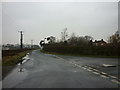
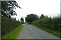
1
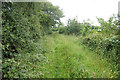
Path towards minor road east of Sandwood Cottage
Image: © Ian S
Taken: 8 Jul 2020
0.11 miles
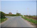
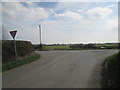
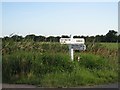
7
Minor road junction sign post
A very local sign, note the field gateway concrete block to stop 4x4's etc from going on the land
Image: © Martin Dawes
Taken: 20 Mar 2019
0.15 miles
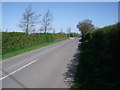
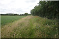
9
Road to Spaldington
Looking along the road to Spaldington near the junction with the road between Wood Lane and the A614.
Image: © DS Pugh
Taken: 30 Aug 2021
0.15 miles
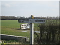
10
Show Me The Way To Go Home
The fingerpost where the lanes meet
Image: © Roger Gilbertson
Taken: 14 Jul 2006
0.15 miles