IMAGES TAKEN NEAR TO
Johnsons Court, GOOLE, DN14 7DB

Introduction

This page details the photographs taken nearby to Johnsons Court, DN14 7DB by members of the Geograph project.

The Geograph project started in 2005 with the aim of publishing, organising and preserving representative images for every square kilometre of Great Britain, Ireland and the Isle of Man.

There are currently over 7.5m images from over14,400 individuals and you can help contribute to the project by visiting https://www.geograph.org.uk

Image Map


Images are licensed for reuse under creativecommons.org/licenses/by-sa/2.0
Notes
  • Clicking on the map will re-center to the selected point.
  • The higher the marker number, the further away the image location is from the centre of the postcode.

Image Listing (341 Images Found)

Images are licensed for reuse under creativecommons.org/licenses/by-sa/2.0
  • ...
Image
Details
Distance
1
No.14, St John?s Street
A grade II listed house of 2 storeys, 3 bays, dated mid C18. Constructed of colour-washed brick in irregular bond with a pantile roof. Central-hallway entry with additional cross wing to rear. SeeImage LBS No: 165362
Image: © Mike Kirby Taken: 22 Oct 2014
0.06 miles
2
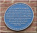
No.14, St John?s Street, blue plaque
Image: © Mike Kirby Taken: 22 Oct 2014
0.06 miles
3
House backs, Northolmby Street
Image: © Chris Taken: 22 Sep 2013
0.06 miles
4
House fronts, Northolmby Street
Image: © Chris Taken: 22 Sep 2013
0.06 miles
5
Entrance to Howden Marsh Local Nature Reserve
Seventeen acres of Howden Marsh have been leased by Howden Town Council from the local authority (now the East Riding of Yorkshire Council) since 1974. The site was designated a Local Nature Reserve in May 2002.
Image: © Chris Taken: 22 Sep 2013
0.07 miles
6
Houses in Howden
A modern setting for an ancient settlement.
Image: © Peter Church Taken: 22 Jan 2006
0.07 miles
7
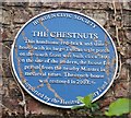
Chestnuts, blue plaque
Image: © Mike Kirby Taken: 22 Oct 2014
0.08 miles
8
Howden Minster Tower at Sunset
Image: © mym Taken: 14 Jun 2003
0.08 miles
9
Chestnuts, No.16, Pinfold St
A grade II listed house of two storeys, dated c1800, with alterations in the 1930's. Constructed in handmade brick, with front facade of machine made red brick, stone dressings and Westmorland slate roof. Central-hallway entry with a Tuscan porch. See Image LBS No:- 165359
Image: © Mike Kirby Taken: 22 Oct 2014
0.08 miles
10
Pinfold Street, Howden
Image: © Ian S Taken: 20 Jul 2016
0.09 miles
  • ...