
IMAGES TAKEN NEAR TO
Marshfield Avenue, GOOLE, DN14 5JJ
Introduction
This page details the photographs taken nearby to Marshfield Avenue, DN14 5JJ by members of the Geograph project.
The Geograph project started in 2005 with the aim of publishing, organising and preserving representative images for every square kilometre of Great Britain, Ireland and the Isle of Man.

There are currently over 7.5m images from over14,400 individuals and you can help contribute to the project by visiting https://www.geograph.org.uk
Image Map
Images are licensed for reuse under creativecommons.org/licenses/by-sa/2.0
Notes
- Clicking on the map will re-center to the selected point.
- The higher the marker number, the further away the image location is from the centre of the postcode.
Image Listing (47 Images Found)
Images are licensed for reuse under creativecommons.org/licenses/by-sa/2.0
Image
Details
Distance
1
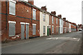
Richard Cooper Street
Terraced houses destined for demolition
Image: © Richard Croft
Taken: 6 May 2010
0.08 miles
2
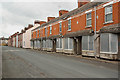
Richard Cooper Street
Terraced houses awaiting re-development
Image: © Richard Croft
Taken: 6 May 2010
0.09 miles
3
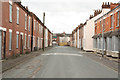
The end is nigh
Street of terraced housing in Goole facing demolition
Image: © Richard Croft
Taken: 6 May 2010
0.09 miles
4
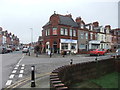
Bric-a-Brac shop, Marshfield Avenue, Goole
This shop takes in the unwanted and sells on for charity. It was the work of Olive Hunt who started it in her own home and soon the activities and the generosity of locals meant she had to expand.
Thousands of pounds were raised over the last 30 years helping many local causes as well as assisting the Inshore Lifeboat at Humber Rescue who named a rescue boat in her honour.
Image: © David Brown
Taken: 8 Mar 2019
0.11 miles
6
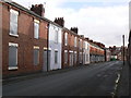
Richard Cooper Street
A street of terrace housing awaiting redevelopment.
Image: © bernard bradley
Taken: 11 Nov 2008
0.13 miles
7

Houses behind the flood wall on Hook Road
The riverside path runs along the top of a levee, with these houses on the street below.
Image: © David Martin
Taken: 10 Apr 2025
0.13 miles
8
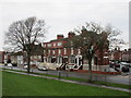
Housing along Hook Road
The houses look across Hook Road to the flood bank which is landscaped and forms a linear park.
Image: © Jonathan Thacker
Taken: 10 Feb 2017
0.13 miles
9
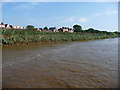
Houses on Hook Road, Goole
On the west bank of the tidal River Ouse. Seen from the barge Sobriety, heading upstream.
Image: © Christine Johnstone
Taken: 24 Aug 2016
0.15 miles
