IMAGES TAKEN NEAR TO
Weeland Road, GOOLE, DN14 0TD
Introduction
This page details the photographs taken nearby to Weeland Road, DN14 0TD by members of the Geograph project.
The Geograph project started in 2005 with the aim of publishing, organising and preserving representative images for every square kilometre of Great Britain, Ireland and the Isle of Man.

There are currently over 7.5m images from over14,400 individuals and you can help contribute to the project by visiting https://www.geograph.org.uk
Image Map
Images are licensed for reuse under creativecommons.org/licenses/by-sa/2.0
Notes
- Clicking on the map will re-center to the selected point.
- The higher the marker number, the further away the image location is from the centre of the postcode.
Image Listing (9 Images Found)
Images are licensed for reuse under creativecommons.org/licenses/by-sa/2.0
Image
Details
Distance
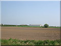
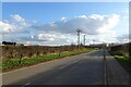
2
Farmland east of Sudforth Lane
On the eastern edge of Kellingley.
Image: © Christine Johnstone
Taken: 12 Dec 2018
0.11 miles
3
![Unknown business premises, off Weeland Road [A645]](https://s1.geograph.org.uk/geophotos/06/00/10/6001049_93b26342_120x120.jpg)
Unknown business premises, off Weeland Road [A645]
Just north of a disused pit. Possibly a transport company?
Image: © Christine Johnstone
Taken: 12 Dec 2018
0.15 miles
4
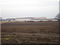
View towards warehouses off Weeland Road
On a misty December afternoon.
Image: © Jonathan Thacker
Taken: 5 Dec 2016
0.16 miles
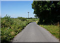
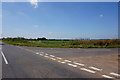
5
Common Lane approaching Weeland Road
Common Lane heads south from Beal to meet Weeland Road just east of Kellingley.
Image: © DS Pugh
Taken: 24 Feb 2024
0.21 miles
7
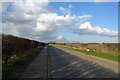
Common Lane
Common Lane heading to Beal near the junction with Weeland Road.
Image: © DS Pugh
Taken: 24 Feb 2024
0.23 miles
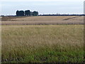
8
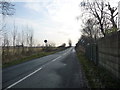
Sudforth Lane
Heading south from Kellingley.
Image: © Christine Johnstone
Taken: 12 Dec 2018
0.24 miles