IMAGES TAKEN NEAR TO
The Oval, GOOLE, DN14 0TA
Introduction
This page details the photographs taken nearby to The Oval, DN14 0TA by members of the Geograph project.
The Geograph project started in 2005 with the aim of publishing, organising and preserving representative images for every square kilometre of Great Britain, Ireland and the Isle of Man.

There are currently over 7.5m images from over14,400 individuals and you can help contribute to the project by visiting https://www.geograph.org.uk
Image Map
Images are licensed for reuse under creativecommons.org/licenses/by-sa/2.0
Notes
- Clicking on the map will re-center to the selected point.
- The higher the marker number, the further away the image location is from the centre of the postcode.
Image Listing (21 Images Found)
Images are licensed for reuse under creativecommons.org/licenses/by-sa/2.0
Image
Details
Distance
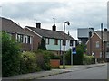
1
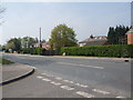
The Oval, west side
A small housing estate at the junction of Sudforth Lane and Weeland Road. Close to Kellingley Colliery and probably built for miners' families.
Image: © Christine Johnstone
Taken: 24 Jun 2011
0.02 miles
2
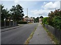
The Oval, northern corner
Small housing estate at the junction of Sudforth Lane and Weeland Road. Close to Kellingley Colliery and probably originally built for miners' families.
Image: © Christine Johnstone
Taken: 24 Jun 2011
0.03 miles
3
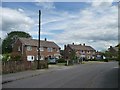
The Oval, north-west corner
Small housing estate at the junction of Sudforth Lane and Weeland Road. Close to Kellingley Colliery and probably originally built for miners' families.
Image: © Christine Johnstone
Taken: 24 Jun 2011
0.03 miles
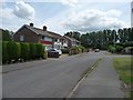
4
The Oval, south side
Small housing estate at the junction of Sudforth Lane and Weeland Road. Close to Kellingley Colliery and probably originally built for miners' families. The colliery headgear is just behind these houses.
Image: © Christine Johnstone
Taken: 24 Jun 2011
0.04 miles
5
Exit and entrance to the Oval
Small housing estate at the junction of Sudforth Lane and Weeland Road. Close to Kellingley Colliery and probably originally built for miners' families.
Image: © Christine Johnstone
Taken: 24 Jun 2011
0.04 miles
6
The Oval, south-east corner
Small housing estate at the junction of Sudforth Lane and Weeland Road. Close to Kellingley Colliery and probably originally built for miners' families.
Image: © Christine Johnstone
Taken: 24 Jun 2011
0.05 miles
7
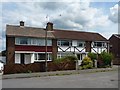
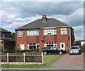
The Oval housing styles
On the left, pretty much as built but with a uPVC door. On the right, with an extension, halt-timbering and Greek columns. The Oval is a small housing estate at the junction of Sudforth Lane and Weeland Road. It is close to Kellingley Colliery and was probably originally built for miners' families.
Image: © Christine Johnstone
Taken: 24 Jun 2011
0.05 miles
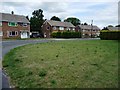
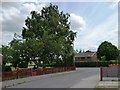
9
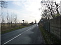
Sudforth Lane
Heading south from Kellingley.
Image: © Christine Johnstone
Taken: 12 Dec 2018
0.10 miles