IMAGES TAKEN NEAR TO
Hazel Old Lane, GOOLE, DN14 0PZ
Introduction
This page details the photographs taken nearby to Hazel Old Lane, DN14 0PZ by members of the Geograph project.
The Geograph project started in 2005 with the aim of publishing, organising and preserving representative images for every square kilometre of Great Britain, Ireland and the Isle of Man.

There are currently over 7.5m images from over14,400 individuals and you can help contribute to the project by visiting https://www.geograph.org.uk
Image Map
Images are licensed for reuse under creativecommons.org/licenses/by-sa/2.0
Notes
- Clicking on the map will re-center to the selected point.
- The higher the marker number, the further away the image location is from the centre of the postcode.
Image Listing (9 Images Found)
Images are licensed for reuse under creativecommons.org/licenses/by-sa/2.0
Image
Details
Distance
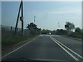
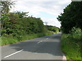
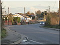
3
Hazel Old Lane
Crossroads with the A645 near Hensall. The disused Eggborough Power Station in the background.
Image: © Alan Murray-Rust
Taken: 24 Dec 2018
0.06 miles
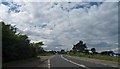
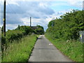
4
Weeland Road near Hensall
On a walk to circumnavigate Eggborough Power Station
Image: © Chris Allen
Taken: 4 Nov 2017
0.07 miles