IMAGES TAKEN NEAR TO
Lime Tree Drive, GOOLE, DN14 0GF
Introduction
This page details the photographs taken nearby to Lime Tree Drive, DN14 0GF by members of the Geograph project.
The Geograph project started in 2005 with the aim of publishing, organising and preserving representative images for every square kilometre of Great Britain, Ireland and the Isle of Man.

There are currently over 7.5m images from over14,400 individuals and you can help contribute to the project by visiting https://www.geograph.org.uk
Image Map
Images are licensed for reuse under creativecommons.org/licenses/by-sa/2.0
Notes
- Clicking on the map will re-center to the selected point.
- The higher the marker number, the further away the image location is from the centre of the postcode.
Image Listing (11 Images Found)
Images are licensed for reuse under creativecommons.org/licenses/by-sa/2.0
Image
Details
Distance
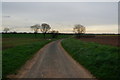
7
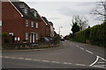
Silver Street, Whitley, junction with the A19
Image: © Bill Henderson
Taken: 24 Sep 2006
0.08 miles
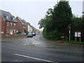
9
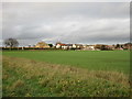
View towards housing on Silver Street, Whitley
Whitley is a rapidly expanding village.
Image: © Jonathan Thacker
Taken: 20 Nov 2015
0.20 miles