
IMAGES TAKEN NEAR TO
Don Street, DONCASTER, DN1 2SF
Introduction
This page details the photographs taken nearby to Don Street, DN1 2SF by members of the Geograph project.
The Geograph project started in 2005 with the aim of publishing, organising and preserving representative images for every square kilometre of Great Britain, Ireland and the Isle of Man.

There are currently over 7.5m images from over14,400 individuals and you can help contribute to the project by visiting https://www.geograph.org.uk
Image Map
Images are licensed for reuse under creativecommons.org/licenses/by-sa/2.0
Notes
- Clicking on the map will re-center to the selected point.
- The higher the marker number, the further away the image location is from the centre of the postcode.
Image Listing (19 Images Found)
Images are licensed for reuse under creativecommons.org/licenses/by-sa/2.0
Image
Details
Distance
2
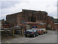
Victoria Mill
Victoria Mill is now a business park, with scaffolding being one of the businesses as well as a bakery.
Image: © Michael Patterson
Taken: 7 Jul 2006
0.18 miles
3
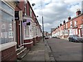
Baxter Avenue, Doncaster
Looking north-west.
Image: © Christine Johnstone
Taken: 1 Sep 2014
0.18 miles

5
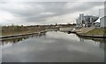
Basin, north side of Chappell Drive
Once a longer arm, that was probably the old course of the River Don. Seen from the barge Sobriety, heading from Goole to Sprotbrough.
Image: © Christine Johnstone
Taken: 4 Apr 2014
0.20 miles
6
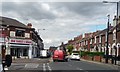
Grab yourself a bargain on Broxholme Lane
The shop, at the corner of Copley Road, was built by the Doncaster Mutual Cooperative Industrial Society in 1884.
Image: © Christine Johnstone
Taken: 1 Sep 2014
0.21 miles
7
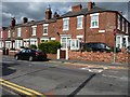
Houses on the east side of King's Road, Doncaster
North of the junction with Highfield Road.
Image: © Christine Johnstone
Taken: 1 Sep 2014
0.21 miles
8
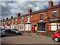
Houses, east side, Baxter Avenue, Doncaster
Unlike most of the nearby houses, these have no front gardens.
Image: © Christine Johnstone
Taken: 1 Sep 2014
0.21 miles
9
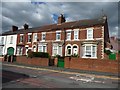
Houses, east side, Queen's Street, Doncaster
North of the junction with Highfield Road.
Image: © Christine Johnstone
Taken: 1 Sep 2014
0.21 miles
10
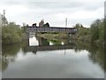
Disused railway bridge, Gas House Bight
Seen from the barge Sobriety, heading from Goole to Sprotbrough.
Image: © Christine Johnstone
Taken: 4 Apr 2014
0.22 miles