
IMAGES TAKEN NEAR TO
All Hallowes Drive, DONCASTER, DN11 9JS
Introduction
This page details the photographs taken nearby to All Hallowes Drive, DN11 9JS by members of the Geograph project.
The Geograph project started in 2005 with the aim of publishing, organising and preserving representative images for every square kilometre of Great Britain, Ireland and the Isle of Man.

There are currently over 7.5m images from over14,400 individuals and you can help contribute to the project by visiting https://www.geograph.org.uk
Image Map
Images are licensed for reuse under creativecommons.org/licenses/by-sa/2.0
Notes
- Clicking on the map will re-center to the selected point.
- The higher the marker number, the further away the image location is from the centre of the postcode.
Image Listing (12 Images Found)
Images are licensed for reuse under creativecommons.org/licenses/by-sa/2.0
Image
Details
Distance
1
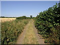
Tree in a Lane
Greystone Lane leads out of Tickhill towards Stainton.
Image: © Michael Patterson
Taken: 13 Jul 2006
0.06 miles
2
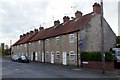
Victoria Terrace
Terraced cottages on St Mary's Road
Image: © Graham Hogg
Taken: 20 Oct 2015
0.16 miles
4
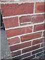
Ordnance Survey Cut Mark
This OS cut mark can be found on No17 King Edward Road. It marks a point 21.202m above mean sea level.
Image: © Adrian Dust
Taken: 22 May 2016
0.20 miles
5
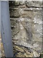
Ordnance Survey Cut Mark
This OS cut mark can be found on No30 North Gate. It marks a point 19.577m above mean sea level.
Image: © Adrian Dust
Taken: 22 May 2016
0.21 miles
7
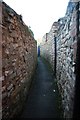
Drury Lane
Narrow thoroughfare between the Market Place and St.Mary's Road
Image: © Richard Croft
Taken: 6 Dec 2008
0.22 miles
9
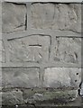
Ordnance Survey Cut Mark
This OS cut mark can be found on Barn House, North Gate. It marks a point 18.818m above mean sea level.
Image: © Adrian Dust
Taken: 22 May 2016
0.24 miles
10
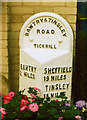
Old Milestone in Northgate, Tickhill
Metal plate attached to stone post, was on A631, in parish of TICKHILL (DONCASTER District), was Bawtry Road, now behind No. 1, Northgate, Tickhill, visible from road, on East side of road. Brayshaw & Booth iron casting, erected by the County Council in the 19th century.
Inscription reads:-
: BAWTRY / 2 MILES : : BAWTRY & TINSLEY / ROAD / TICKHILL : : SHEFFIELD / 19 MILES / TINSLEY / 15 MILES / ROTHERHAM / 12¾ MILES / TICKHILL / 1¾ MILES :
Maker:-
: BRAYSHAW & BOOTH / MAKERS / LIVERSEDGE :
Milestone Society National ID: YS_TYBW15.
Image: © C Minto
Taken: 5 May 2006
0.24 miles