IMAGES TAKEN NEAR TO
Hall Balk Lane, DONCASTER, DN11 9DG
Introduction
This page details the photographs taken nearby to Hall Balk Lane, DN11 9DG by members of the Geograph project.
The Geograph project started in 2005 with the aim of publishing, organising and preserving representative images for every square kilometre of Great Britain, Ireland and the Isle of Man.

There are currently over 7.5m images from over14,400 individuals and you can help contribute to the project by visiting https://www.geograph.org.uk
Image Map
Images are licensed for reuse under creativecommons.org/licenses/by-sa/2.0
Notes
- Clicking on the map will re-center to the selected point.
- The higher the marker number, the further away the image location is from the centre of the postcode.
Image Listing (8 Images Found)
Images are licensed for reuse under creativecommons.org/licenses/by-sa/2.0
Image
Details
Distance
1
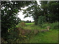
View towards the motorway
The M18 is immediately behind the high hedge in the background. It cannot be seen but it most certainly can be heard. Taken from Hall Balk Lane.
Image: © Jonathan Thacker
Taken: 4 Aug 2012
0.04 miles
2
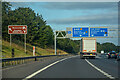
Loversall : M18 Motorway
Approaching Junction 3 of the M18 Motorway.
Image: © Lewis Clarke
Taken: 20 Sep 2020
0.11 miles
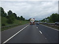
4
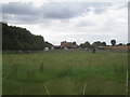
Paddocks by the A60
The A60 is behind the hedge. Taken from Hall Balk Lane.
Image: © Jonathan Thacker
Taken: 4 Aug 2012
0.20 miles
5
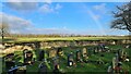
Rainbow over St Katherine?s graveyard, Loversall
Image: © Chris Morgan
Taken: 13 Jan 2023
0.21 miles
6
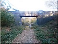
Bridge Over Disused Railway Line
This is Occupation Railway Bridge (number 7.079) passing over a former mineral line which served Yorkshire Main Colliery.
Image: © Jonathan Clitheroe
Taken: 2 Nov 2016
0.23 miles
7
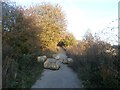
Strategically Placed Boulders
This former railway line is now a recreational path which will most likely see more footfall in the future as the outer fringes of Doncaster continue to encroach. The rocks are a common deterrent against joyriders and the like.
Image: © Jonathan Clitheroe
Taken: 2 Nov 2016
0.23 miles