
IMAGES TAKEN NEAR TO
Opal Grove, DONCASTER, DN11 8FF
Introduction
This page details the photographs taken nearby to Opal Grove, DN11 8FF by members of the Geograph project.
The Geograph project started in 2005 with the aim of publishing, organising and preserving representative images for every square kilometre of Great Britain, Ireland and the Isle of Man.

There are currently over 7.5m images from over14,400 individuals and you can help contribute to the project by visiting https://www.geograph.org.uk
Image Map
Images are licensed for reuse under creativecommons.org/licenses/by-sa/2.0
Notes
- Clicking on the map will re-center to the selected point.
- The higher the marker number, the further away the image location is from the centre of the postcode.
Image Listing (8 Images Found)
Images are licensed for reuse under creativecommons.org/licenses/by-sa/2.0
Image
Details
Distance
1
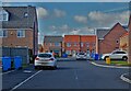
Modern housing at Harworth
On Avalon Gardens. Honestly, who comes up with such fancy names?
Image: © Neil Theasby
Taken: 1 Mar 2022
0.01 miles
2
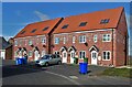
Avalon Gardens
New housing to the north of Harworth
Image: © Neil Theasby
Taken: 1 Mar 2022
0.06 miles
3
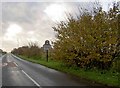
Welcome to Harworth and Bircotes
Opposite the mobile home park.
Image: © Steve Fareham
Taken: 11 Nov 2008
0.06 miles
4
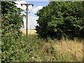
Pylons Through a Gap
The woodland to the right is Swinnow Wood. This pylon which appears to be the first or last in the line takes advantage of the gap between the trees.
Image: © Michael Patterson
Taken: 14 Jul 2006
0.15 miles
7
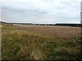
Field near Bawtry Road
The overgrown track on the left heads to Tickhill Grange.
Image: © Jonathan Clitheroe
Taken: 7 Oct 2016
0.23 miles
8
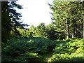
Spinnow wood
Coniferous woodland just north of Harworth
Image: © Ashley Dace
Taken: 17 Aug 2006
0.24 miles