IMAGES TAKEN NEAR TO
Plumtree Farm Industrial Estate, Plumtree Road, DONCASTER, DN11 8EW
Introduction
This page details the photographs taken nearby to Plumtree Farm Industrial Estate, Plumtree Road, DN11 8EW by members of the Geograph project.
The Geograph project started in 2005 with the aim of publishing, organising and preserving representative images for every square kilometre of Great Britain, Ireland and the Isle of Man.

There are currently over 7.5m images from over14,400 individuals and you can help contribute to the project by visiting https://www.geograph.org.uk
Image Map
Images are licensed for reuse under creativecommons.org/licenses/by-sa/2.0
Notes
- Clicking on the map will re-center to the selected point.
- The higher the marker number, the further away the image location is from the centre of the postcode.
Image Listing (14 Images Found)
Images are licensed for reuse under creativecommons.org/licenses/by-sa/2.0
Image
Details
Distance
1

Plumtree Farm Industrial Estate entrance
Image: © Steve Fareham
Taken: 4 Jul 2008
0.06 miles
2
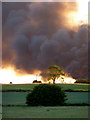
Smoke rising from Plumtree Farm industrial estate
The fire was a major incident on a beautiful summer evening. A zoom shot from the track northwest from the A614 at Gibbet Hill.
Image: © Andrew Hill
Taken: 16 Jun 2010
0.06 miles
5
Plumtree Farm
The farm has now become industry, this being just a part of the Plumtree Farm industrial estate.
Image: © Michael Patterson
Taken: 14 Jul 2006
0.10 miles
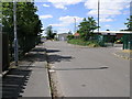
6
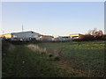
Path and the edge of Plumtree Farm Industrial Estate
This is not a public footpath but it well used by pedestrians and horse riders.
Image: © Jonathan Thacker
Taken: 12 Dec 2018
0.10 miles
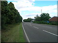
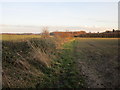
7
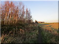
Footpath to Tickhill Road
Plumtree Farm Industrial Estate to the left.
Image: © Jonathan Thacker
Taken: 12 Dec 2018
0.14 miles
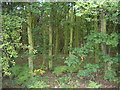
8

Spinnow wood
The Coniferous woodland just north of Harworth.
Image: © Ashley Dace
Taken: 17 Aug 2007
0.17 miles
10
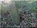
NEW
Old milestone
On the right edge of the milestone is a well-cut benchmark. Superseded by modern technology, in the past milestones were often used by the Ordnance Survey. This also shows the way the back edges were angled.
Image: © Chris Minto
Taken: 8 Mar 2025
0.22 miles